File:Boswell Bay White Alice Communications System site.jpg

Original file (4,701 × 3,704 pixels, file size: 3.61 MB, MIME type: image/jpeg)
Captions
Captions
Summary[edit]
| Description |
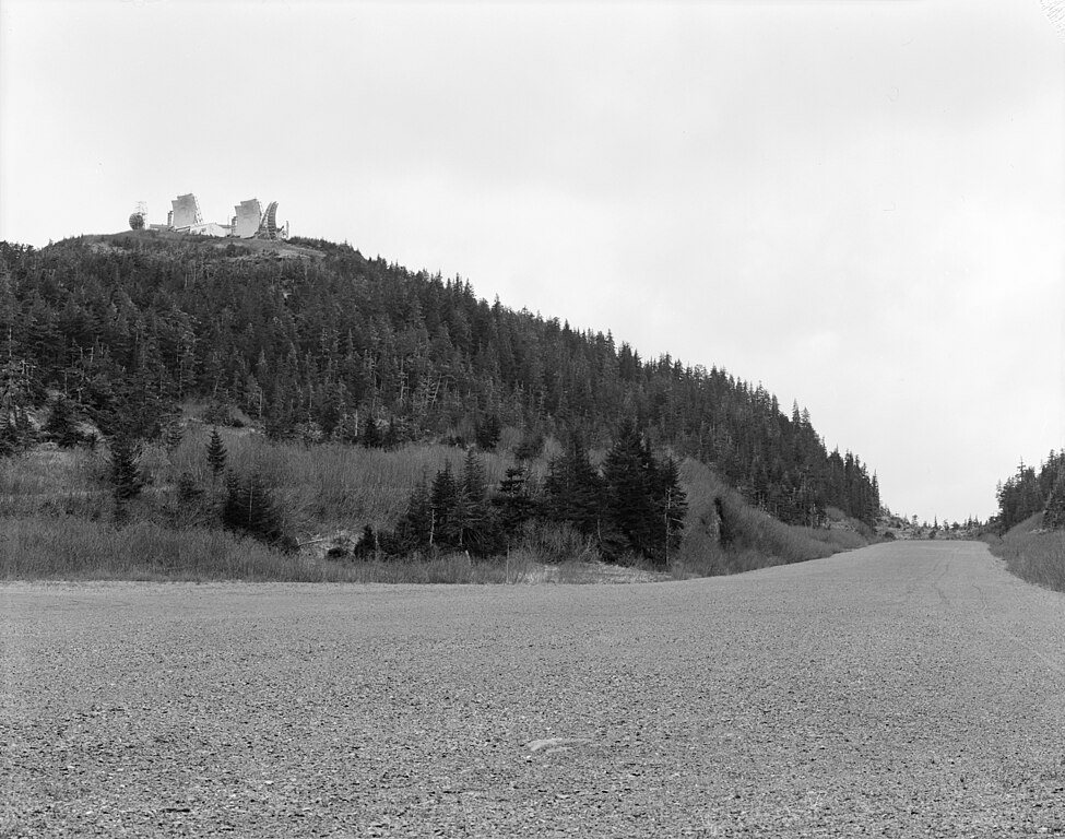
English: Boswell Bay White Alice Communications System site, southwest overview, Chugach National Forest, Cordova vicinity of Valdez-Cordova District, AK.
This image was found at the Library of Congress HAER archive entry with the original caption: "OVERVIEW OF SITE, LOOKING SOUTHWEST HAER AK,20-CORD.V,2-1" (Mirrored image to make words readable, slide must have been scanned in upside down on source site) It is a part of the Historic American Engineering Record collection of photos. Image taken by Rob Stapleton, June 1987.
|
||
| Date | Taken in June 1987, 9 February 2006 (original upload date) | ||
| Source |
|
||
| Author | Rob Stapleton (photographer), original uploader was Dual Freq at en.wikipedia |

| Camera location | | View this and other nearby images on: OpenStreetMap |
|---|
Licensing[edit]

|
This file comes from the Historic American Buildings Survey (HABS), Historic American Engineering Record (HAER) or Historic American Landscapes Survey (HALS). These are programs of the National Park Service established for the purpose of documenting historic places. Records consist of measured drawings, archival photographs, and written reports.
|
| This image or media file contains material based on a work of a National Park Service employee, created as part of that person's official duties. As a work of the U.S. federal government, such work is in the public domain in the United States. See the NPS website and NPS copyright policy for more information. |
Original upload log[edit]
- 2006-02-09 12:18 Dual Freq 1024×815× (142849 bytes) Boswell Bay White Alice Site, Overview, Chugach National Forest, Cordova vicinity, Valdez-Cordova District, AK This image was found at the Library of Congress HAER archive entry with the original caption: "OVERVIEW OF SITE, LOOKING SOUTHWEST HAER AK,20-C
File history
Click on a date/time to view the file as it appeared at that time.
| Date/Time | Thumbnail | Dimensions | User | Comment | |
|---|---|---|---|---|---|
| current | 20:45, 13 August 2011 | | 4,701 × 3,704 (3.61 MB) | Ras67 (talk | contribs) | high resolution |
| 13:24, 19 December 2010 |  | 1,024 × 815 (140 KB) | File Upload Bot (Magnus Manske) (talk | contribs) | {{BotMoveToCommons|en.wikipedia|year={{subst:CURRENTYEAR}}|month={{subst:CURRENTMONTHNAME}}|day={{subst:CURRENTDAY}}}} {{Information |Description={{en|'''Boswell Bay White Alice Communications System site''', sou |
You cannot overwrite this file.
File usage on Commons
The following page uses this file:
- File:000931pv.jpg (file redirect)
File usage on other wikis
The following other wikis use this file:
- Usage on en.wikipedia.org
- Usage on fr.wikipedia.org
- Usage on ru.wikipedia.org