File:Brandner Gletscher 2016.jpg
Jump to navigation
Jump to search

Size of this preview: 800 × 494 pixels. Other resolutions: 320 × 198 pixels | 640 × 395 pixels | 1,024 × 632 pixels | 1,280 × 790 pixels | 2,560 × 1,581 pixels | 4,858 × 3,000 pixels.
Original file (4,858 × 3,000 pixels, file size: 10.81 MB, MIME type: image/jpeg)
Captions
Captions
Add a one-line explanation of what this file represents
Summary[edit]
| Description |
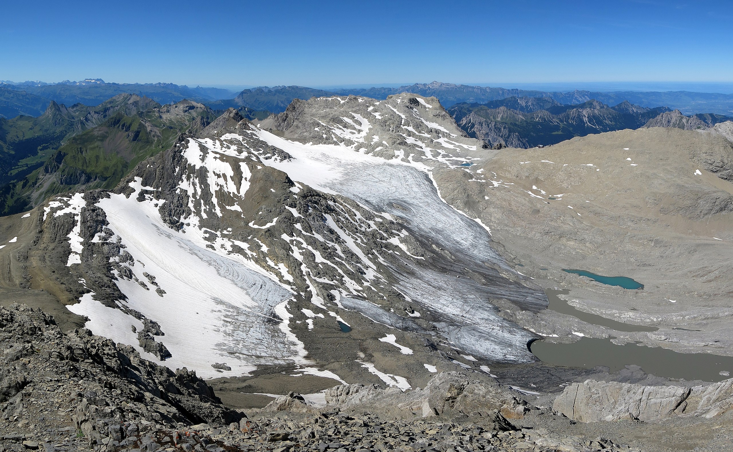
Deutsch: Blick von der Schesaplana auf den Brandner Gletscher
English: Brandner glacier seen from the summit of Schesaplana |
| Date | |
| Source | Own work |
| Author | Jörg Braukmann |
| Camera location | | View this and other nearby images on: OpenStreetMap |
|---|

|
Diese Datei wurde im Rahmen von WikiDaheim 2017 in Österreich erstellt und hochgeladen. Sie wurde dem Themenbereich Naturschutz zugeordnet. |
Licensing[edit]
I, the copyright holder of this work, hereby publish it under the following license:
This file is licensed under the Creative Commons Attribution-Share Alike 4.0 International license.
- You are free:
- to share – to copy, distribute and transmit the work
- to remix – to adapt the work
- Under the following conditions:
- attribution – You must give appropriate credit, provide a link to the license, and indicate if changes were made. You may do so in any reasonable manner, but not in any way that suggests the licensor endorses you or your use.
- share alike – If you remix, transform, or build upon the material, you must distribute your contributions under the same or compatible license as the original.
| Annotations | This image is annotated: View the annotations at Commons |

This image has been assessed using the Quality image guidelines and is considered a Quality image.
|

|
This image has been assessed under the valued image criteria and is considered the most valued image on Commons within the scope: Brandner Glacier seen from Schesaplana summit in 2016. You can see its nomination here. |
File history
Click on a date/time to view the file as it appeared at that time.
| Date/Time | Thumbnail | Dimensions | User | Comment | |
|---|---|---|---|---|---|
| current | 15:27, 1 September 2017 | | 4,858 × 3,000 (10.81 MB) | Milseburg (talk | contribs) | User created page with UploadWizard |
You cannot overwrite this file.
File usage on Commons
The following 6 pages use this file:
- WikiDaheim Vorjury 2017
- User:Plani/Vorarlberg new files/2017 September 1-10
- User talk:Milseburg/Archiv 2018 und älter
- Commons:Quality images/Subject/Places/Natural structures/archive 2017
- Commons:Quality images candidates/Archives September 04 2017
- Commons:Valued image candidates/Brandner Gletscher 2016.jpg
File usage on other wikis
The following other wikis use this file:
- Usage on de.wikipedia.org