File:Brazil Distrito Federal location map.svg
Jump to navigation
Jump to search

Size of this PNG preview of this SVG file: 800 × 466 pixels. Other resolutions: 320 × 186 pixels | 640 × 373 pixels | 1,024 × 596 pixels | 1,280 × 745 pixels | 2,560 × 1,490 pixels | 974 × 567 pixels.
Original file (SVG file, nominally 974 × 567 pixels, file size: 1.85 MB)
Captions
Captions
Add a one-line explanation of what this file represents
| Description |
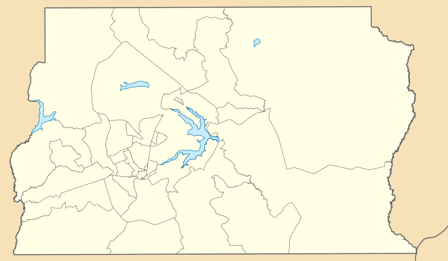
English: Location map of Federal District, Brazil.
Equirectangular projection, N/S stretching 104 %. Geographic limits of the map:
|
| Date | (UTC) |
| Source | |
| Author |
|
I, the copyright holder of this work, hereby publish it under the following licenses:
This file is licensed under the Creative Commons Attribution 2.5 Generic license.
- You are free:
- to share – to copy, distribute and transmit the work
- to remix – to adapt the work
- Under the following conditions:
- attribution – You must give appropriate credit, provide a link to the license, and indicate if changes were made. You may do so in any reasonable manner, but not in any way that suggests the licensor endorses you or your use.
| This file is licensed under the Creative Commons Attribution-Share Alike 3.0 Unported license. | ||
| ||
| This licensing tag was added to this file as part of the GFDL licensing update. |

|
Permission is granted to copy, distribute and/or modify this document under the terms of the GNU Free Documentation License, Version 1.2 or any later version published by the Free Software Foundation; with no Invariant Sections, no Front-Cover Texts, and no Back-Cover Texts. A copy of the license is included in the section entitled GNU Free Documentation License. |
You may select the license of your choice.
Uploaded with derivativeFX
File history
Click on a date/time to view the file as it appeared at that time.
| Date/Time | Thumbnail | Dimensions | User | Comment | |
|---|---|---|---|---|---|
| current | 18:23, 18 November 2022 | | 974 × 567 (1.85 MB) | GrandEscogriffe (talk | contribs) | more correct north-south stretching |
| 22:08, 4 April 2020 |  | 974 × 545 (1.77 MB) | Furious97 (talk | contribs) | Limites das regiões administrativas atualizados conforme a [http://www.buriti.df.gov.br/ftp/diariooficial/2019/12_Dezembro/DODF%20243%2023-12-2019%20SUPLEMENTO%20C/DODF%20243%2023-12-2019%20SUPLEMENTO%20C.pdf Lei Complementar nº 958/2019 (Distrito Federal)]. | |
| 20:23, 20 January 2019 |  | 974 × 545 (240 KB) | Milenioscuro (talk | contribs) | Does not match with the color conventions | |
| 23:21, 18 January 2019 |  | 974 × 545 (240 KB) | Allice Hunter (talk | contribs) | Final Version | |
| 18:57, 4 January 2019 |  | 974 × 545 (240 KB) | Allice Hunter (talk | contribs) | Reverted to version as of 22:05, 3 January 2019 (UTC) | |
| 22:10, 3 January 2019 |  | 974 × 545 (240 KB) | Allice Hunter (talk | contribs) | New Colour | |
| 22:05, 3 January 2019 |  | 974 × 545 (240 KB) | Allice Hunter (talk | contribs) | Novas regiões administrativas do DF | |
| 20:17, 12 August 2011 |  | 974 × 545 (364 KB) | Milenioscuro (talk | contribs) | {{Information |Description='''English:''' Location map of Federal District, Brazil.<br> '''Português:''' Mapa de localização de Distrito federal, [[w:pt:Brasil|Brasi |
You cannot overwrite this file.
File usage on Commons
The following 2 pages use this file:
.svg)
File usage on other wikis
The following other wikis use this file:
- Usage on arz.wikipedia.org
- Usage on de.wikipedia.org
- Fernsehturm Brasília
- Juscelino-Kubitschek-Brücke
- Wikipedia:Kartenwerkstatt/Positionskarten/Südamerika
- Estádio Mané Garrincha
- Benutzer:Matthiasb/Vorlage:Infobox Ort in Südamerika/Test
- Neuer Fernsehturm Brasília
- Vorlage:Positionskarte Brasilien Distrito Federal do Brasil
- Estádio Nacional de Brasília Mané Garrincha
- Ginásio Nilson Nelson
- Zoologischer Garten Brasília
- Usage on eo.wikipedia.org
- Federacia Distrikto (Brazilo)
- Brazila Nacia Instituto pri Historia kaj Arta Heredaĵo
- Palácio da Alvorada
- Praça dos Três Poderes
- Katedralo de Braziljo
- Ministerio de Scienco, Teknologio kaj Novaĵo de Brazilo
- Nacia Kongreso de Brazilo
- Catetinho
- Ŝablono:Situo sur mapo Brazilo Federacia distrikto
- Centra Banko de Brazilo
- Brazila Senato
- Ĉambro de Deputitoj (Brazilo)
- Supera Tribunalo de Brazilo
- Universitato de Braziljo
- Usage on es.wikipedia.org
- Brasilia
- Distrito Federal (Brasil)
- Aeropuerto Internacional Presidente Juscelino Kubitschek
- Wikiproyecto:Ilustración/Taller de Cartografía/Realizaciones/América del Sur
- Plantilla:Mapa de localización de Distrito Federal (Brasil)
- Águas Claras (Distrito Federal)
- Anexo:Regiones del Distrito Federal de Brasil
- Usage on fr.wikipedia.org
- Brasilia
- Place des Trois Pouvoirs
- Stade national de Brasilia Mané Garrincha
- Taguatinga (District fédéral)
- Wikipédia:Atelier modèle de géolocalisation
- Autódromo Internacional Nelson Piquet (Brasília)
- Gama (District fédéral)
- Brazlândia
- Sobradinho (District fédéral)
- Planaltina (District fédéral)
- Paranoá
- Núcleo Bandeirante
- Ceilândia
- Guará (District fédéral)
- Cruzeiro (District fédéral)
- Samambaia (District fédéral)
- Santa Maria (District fédéral)
- São Sebastião (District fédéral)
View more global usage of this file.