File:Byeonhan.png
Jump to navigation
Jump to search
No higher resolution available.
Byeonhan.png (258 × 254 pixels, file size: 30 KB, MIME type: image/png)
Captions
Captions
Add a one-line explanation of what this file represents
Summary[edit]
| Description |
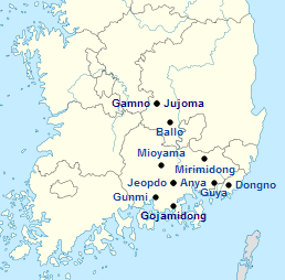
English: Map of the states of the Byeonhan confederacy |
| Date | (UTC) |
| Source |
This file was derived from: South Korea location map.svg: |
| Author |
|
| This is a retouched picture, which means that it has been digitally altered from its original version. The original can be viewed here: South Korea location map.svg:
|
Licensing[edit]
I, the copyright holder of this work, hereby publish it under the following licenses:
This file is licensed under the Creative Commons Attribution-Share Alike 3.0 Unported license.
- You are free:
- to share – to copy, distribute and transmit the work
- to remix – to adapt the work
- Under the following conditions:
- attribution – You must give appropriate credit, provide a link to the license, and indicate if changes were made. You may do so in any reasonable manner, but not in any way that suggests the licensor endorses you or your use.
- share alike – If you remix, transform, or build upon the material, you must distribute your contributions under the same or compatible license as the original.

|
Permission is granted to copy, distribute and/or modify this document under the terms of the GNU Free Documentation License, Version 1.2 or any later version published by the Free Software Foundation; with no Invariant Sections, no Front-Cover Texts, and no Back-Cover Texts. A copy of the license is included in the section entitled GNU Free Documentation License. |
You may select the license of your choice.
Original upload log[edit]
This image is a derivative work of the following images:
- File:South_Korea_location_map.svg licensed with Cc-by-sa-3.0, GFDL
- 2012-06-02T10:48:50Z Geoarchive 1772x1672 (384653 Bytes) Update Sejong Special Autonomous City
- 2010-10-24T17:48:10Z NordNordWest 1772x1672 (386497 Bytes) upd
- 2010-10-02T20:05:03Z NordNordWest 1559x1672 (357245 Bytes) upd
- 2008-08-26T18:57:44Z NordNordWest 1559x1673 (513639 Bytes) {{Information |Description= {{de|Positionskarte von [[:de:Südkorea|Südkorea]]}} Quadratische Plattkarte, N-S-Streckung 120 %. Geographische Begrenzung der Karte: * N: 38.9° N * S: 33.0° N * W: 124.5° O * O: 131.1° O {{e
Uploaded with derivativeFX
File history
Click on a date/time to view the file as it appeared at that time.
| Date/Time | Thumbnail | Dimensions | User | Comment | |
|---|---|---|---|---|---|
| current | 23:54, 8 March 2013 | | 258 × 254 (30 KB) | TKostolany (talk | contribs) | == {{int:filedesc}} == {{Information |Description={{en|Map of the states of the Byeonhan confederacy}} |Source={{Derived from|South_Korea_location_map.svg|display=50}} |Date=2013-03-08 23:06 (UTC) |Author=*[[:File:South_Korea_location_map.svg|South_Kor... |
You cannot overwrite this file.
File usage on Commons
There are no pages that use this file.
File usage on other wikis
The following other wikis use this file:
- Usage on fr.wikipedia.org
- Usage on pt.wikipedia.org