File:Byzantium - ru.svg
Jump to navigation
Jump to search

Size of this PNG preview of this SVG file: 800 × 415 pixels. Other resolutions: 320 × 166 pixels | 640 × 332 pixels | 1,024 × 532 pixels | 1,280 × 665 pixels | 2,560 × 1,329 pixels | 1,710 × 888 pixels.
Original file (SVG file, nominally 1,710 × 888 pixels, file size: 2.35 MB)
Captions
Captions
Add a one-line explanation of what this file represents
This W3C-unspecified vector image was created with Inkscape .
W3C-validity not checked.
Summary[edit]
| Description |
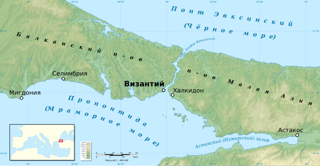
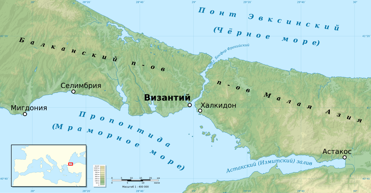
Русский: Древнегреческий город Византий и его окрестности. Українська: Давньогрецьке місто Візантій та його околиці. English: Ancient Greek city Bysantium and its surroundings. |
| Date | |
| Source |
Own work
|
| Author | Kaidor |
| Permission (Reusing this file) |
I, the copyright holder of this work, hereby publish it under the following license: This file is licensed under the Creative Commons Attribution-Share Alike 3.0 Unported license.
|

|
This SVG file contains embedded text that can be translated into your language, using any capable SVG editor, text editor or the SVG Translate tool. For more information see: About translating SVG files. |
File history
Click on a date/time to view the file as it appeared at that time.
| Date/Time | Thumbnail | Dimensions | User | Comment | |
|---|---|---|---|---|---|
| current | 19:36, 9 July 2013 | | 1,710 × 888 (2.35 MB) | Kaidor (talk | contribs) | Увеличена миникарта. Уточнены надписи. Убраны часть озёр. |
| 20:46, 8 July 2013 |  | 1,710 × 888 (2.33 MB) | Kaidor (talk | contribs) | Текст → в кривые | |
| 20:31, 7 July 2013 |  | 1,710 × 888 (2.24 MB) | Kaidor (talk | contribs) | User created page with UploadWizard |
You cannot overwrite this file.
File usage on Commons
The following page uses this file:
File usage on other wikis
The following other wikis use this file:
- Usage on ru.wikipedia.org
- Usage on uk.wikipedia.org