File:Chad relief map 1991, CIA.jpg
Jump to navigation
Jump to search

Size of this preview: 503 × 599 pixels. Other resolutions: 201 × 240 pixels | 403 × 480 pixels | 645 × 768 pixels | 1,036 × 1,234 pixels.
Original file (1,036 × 1,234 pixels, file size: 196 KB, MIME type: image/jpeg)
Captions
Captions
Add a one-line explanation of what this file represents
Summary[edit]
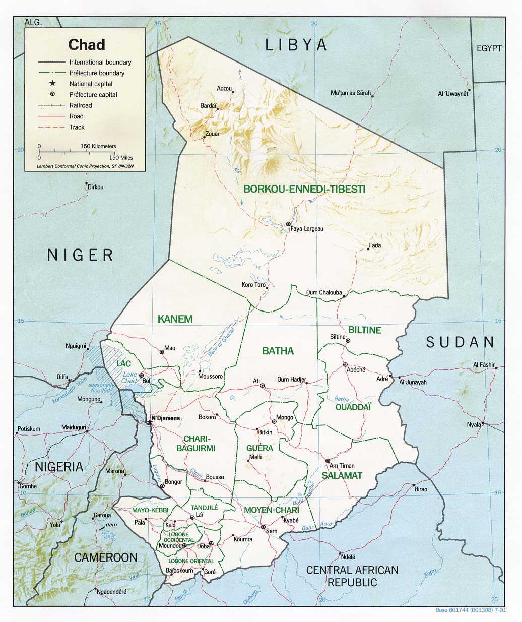
| Description | Shaded relief map of Chad, 1991, produced by the U.S. Central Intelligence Agency. |
| Date | |
| Source | University of Texas Libraries, Perry-Castañeda Library Map Collection: Chad Maps |
| Author | CIA |
Licensing[edit]
| This image is a work of a Central Intelligence Agency employee, taken or made as part of that person's official duties. As a Work of the United States Government, this image or media is in the public domain in the United States.
|

|
File history
Click on a date/time to view the file as it appeared at that time.
| Date/Time | Thumbnail | Dimensions | User | Comment | |
|---|---|---|---|---|---|
| current | 11:58, 21 February 2006 | | 1,036 × 1,234 (196 KB) | Lupo (talk | contribs) | Shaded relief map of Chad. Source: [http://www.lib.utexas.edu/maps/africa/chad_rel91.jpg] from the [http://www.lib.utexas.edu/maps/chad.html Perry-Castañeda Library Map Collection]. {{PD-USGov-CIA}} Category:Maps of Chad |
You cannot overwrite this file.
File usage on Commons
The following page uses this file:
File usage on other wikis
The following other wikis use this file:
- Usage on ast.wikipedia.org
- Usage on azb.wikipedia.org
- Usage on az.wikipedia.org
- Usage on be.wikipedia.org
- Usage on bg.wikipedia.org
- Usage on ca.wikipedia.org
- Usage on cs.wikipedia.org
- Usage on cv.wikipedia.org
- Usage on da.wikipedia.org
- Usage on de.wikipedia.org
- Usage on en.wikipedia.org
- Usage on es.wikipedia.org
- Usage on fr.wikipedia.org
- Usage on hr.wiktionary.org
- Usage on id.wikipedia.org
- Usage on it.wikipedia.org
- Usage on ja.wikipedia.org
- Usage on lt.wikipedia.org
- Usage on mt.wikipedia.org
- Usage on no.wikipedia.org
- Usage on os.wikipedia.org
- Usage on pl.wikipedia.org
- Usage on ru.wikipedia.org
- Usage on sv.wikipedia.org
- Usage on uk.wikipedia.org
- Користувач:Alex Blokha/Події в Вікіпедії/20 червня
- Користувач:Alex Blokha/Події в Вікіпедії/25 червня
- Користувач:Alex Blokha/Події в Вікіпедії/26 червня
- Користувач:Alex Blokha/Події в Вікіпедії/27 червня
- Користувач:Alex Blokha/Події в Вікіпедії/4 липня
- Користувач:Alex Blokha/Події в Вікіпедії/19 липня
- Користувач:Alex Blokha/Події в Вікіпедії/24 липня
- Користувач:Alex Blokha/Події в Вікіпедії/10 серпня
- Користувач:Alex Blokha/Події в Вікіпедії/12 серпня
- Користувач:Alex Blokha/Події в Вікіпедії/20 серпня
- Користувач:Alex Blokha/Події в Вікіпедії/17 вересня
View more global usage of this file.