File:Chantry Mill - geograph.org.uk - 1002850.jpg
Jump to navigation
Jump to search
No higher resolution available.
Chantry_Mill_-_geograph.org.uk_-_1002850.jpg (640 × 479 pixels, file size: 170 KB, MIME type: image/jpeg)
Captions
Captions
Add a one-line explanation of what this file represents
Summary[edit]
| Description |
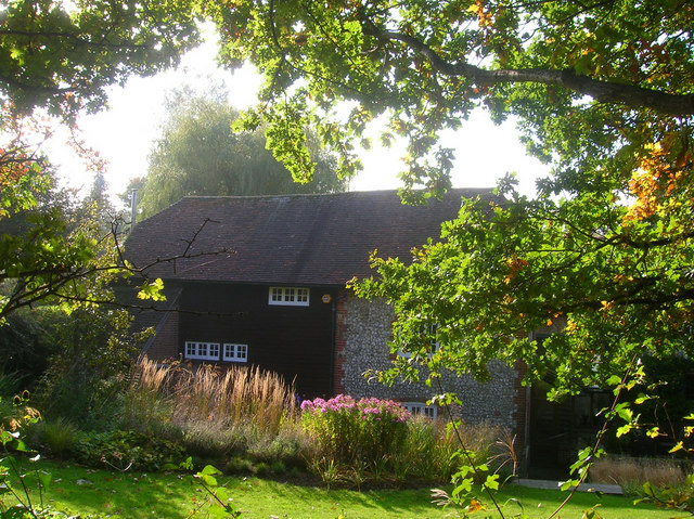
English: Chantry Mill The view from the footpath over the fence. A watermill has operated from this spot since the 13th century, sometimes known as Park Mill as there two mills operating down Chantry Lane in the 18th century. Until circa 1826 it was used as a fulling mill then changed its function to grind corn until 1918 when it was briefly used to power electricity for nearby Sullington. It is now a private house. |
| Date | |
| Source | From geograph.org.uk |
| Author | Simon Carey |
| Attribution (required by the license) | Simon Carey / Chantry Mill / |
| Camera location | | View this and other nearby images on: OpenStreetMap |
|---|
_heading:225.00&language=en)
| Object location | | View this and other nearby images on: OpenStreetMap |
|---|
_heading:225.00&language=en)
Licensing[edit]

|
This image was taken from the Geograph project collection. See this photograph's page on the Geograph website for the photographer's contact details. The copyright on this image is owned by Simon Carey and is licensed for reuse under the Creative Commons Attribution-ShareAlike 2.0 license.
|
This file is licensed under the Creative Commons Attribution-Share Alike 2.0 Generic license.
Attribution: Simon Carey
- You are free:
- to share – to copy, distribute and transmit the work
- to remix – to adapt the work
- Under the following conditions:
- attribution – You must give appropriate credit, provide a link to the license, and indicate if changes were made. You may do so in any reasonable manner, but not in any way that suggests the licensor endorses you or your use.
- share alike – If you remix, transform, or build upon the material, you must distribute your contributions under the same or compatible license as the original.
File history
Click on a date/time to view the file as it appeared at that time.
| Date/Time | Thumbnail | Dimensions | User | Comment | |
|---|---|---|---|---|---|
| current | 06:55, 23 February 2011 | | 640 × 479 (170 KB) | GeographBot (talk | contribs) | == {{int:filedesc}} == {{Information |description={{en|1=Chantry Mill The view from the footpath over the fence. A watermill has operated from this spot since the 13th century, sometimes known as Park Mill as there two mills operating down Chantry Lane in |
You cannot overwrite this file.
File usage on Commons
There are no pages that use this file.