File:DEU BS Cityring Ost Stobenstrasse 887 MSZ120220.JPG
Jump to navigation
Jump to search
Size of this preview: 800 × 513 pixels. Other resolutions: 320 × 205 pixels | 640 × 410 pixels | 1,024 × 656 pixels | 1,280 × 820 pixels | 2,000 × 1,282 pixels.
Original file (2,000 × 1,282 pixels, file size: 2.32 MB, MIME type: image/jpeg)
Captions
Captions
Add a one-line explanation of what this file represents
Summary[edit]
| Camera location | | View this and other nearby images on: OpenStreetMap |
|---|
| Description |
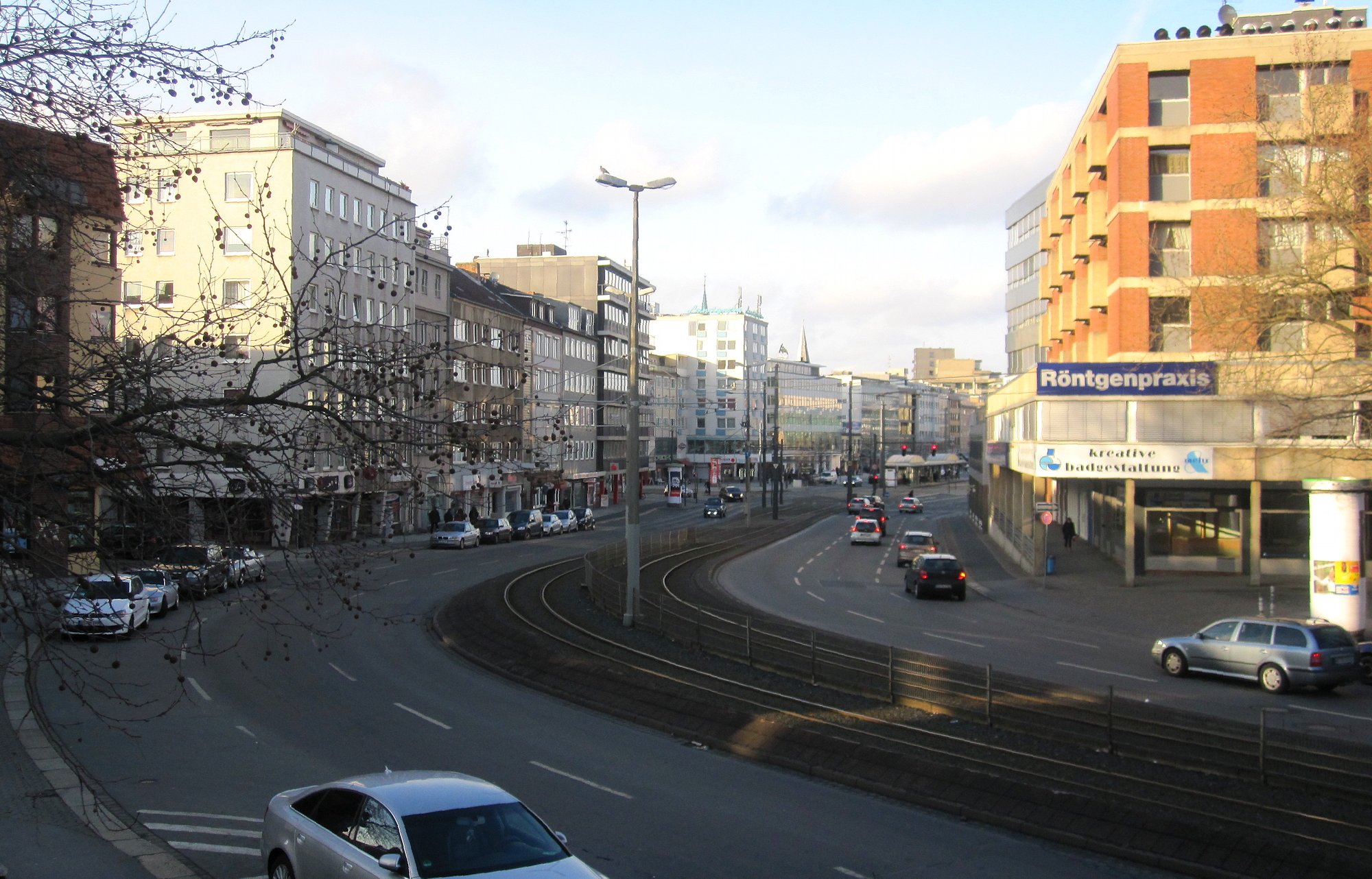
Deutsch: Cityring Ost in Braunschweig: Blick vom Ägidienmarkt in die Stobenstraße. Am linken Bildrand ist die Einmündung der Straße Rosenhagen zu sehen, in der Bildmitte der Mündungsbereich von Stobenstraße, Waisenhausdamm und Bohlweg. |
| Date | |
| Source | Own work |
| Author | Monstourz |
Licensing[edit]
I, the copyright holder of this work, hereby publish it under the following license:
This file is licensed under the Creative Commons Attribution-Share Alike 3.0 Unported license.
- You are free:
- to share – to copy, distribute and transmit the work
- to remix – to adapt the work
- Under the following conditions:
- attribution – You must give appropriate credit, provide a link to the license, and indicate if changes were made. You may do so in any reasonable manner, but not in any way that suggests the licensor endorses you or your use.
- share alike – If you remix, transform, or build upon the material, you must distribute your contributions under the same or compatible license as the original.
File history
Click on a date/time to view the file as it appeared at that time.
| Date/Time | Thumbnail | Dimensions | User | Comment | |
|---|---|---|---|---|---|
| current | 11:33, 23 February 2012 | | 2,000 × 1,282 (2.32 MB) | Monstourz (talk | contribs) |
You cannot overwrite this file.
File usage on Commons
The following page uses this file: