File:Dease and Simpson - Arctic expedition 1837.png
Jump to navigation
Jump to search

Size of this preview: 800 × 472 pixels. Other resolutions: 320 × 189 pixels | 640 × 378 pixels | 1,024 × 605 pixels | 1,280 × 756 pixels | 2,395 × 1,414 pixels.
Original file (2,395 × 1,414 pixels, file size: 288 KB, MIME type: image/png)
Captions
Captions
Add a one-line explanation of what this file represents
Summary[edit]
| Description |
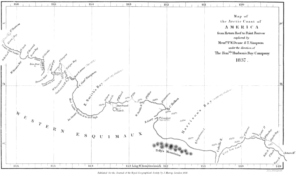
English: Map of the northern coast of Alaska, from Point Burrow on the western edge to Return Reef (just east of the Colville River) on the eastern. Mapped by Peter W. Dease and Thomas Simpson in 1837, during their Arctic expedition. |
|||||||||||||||||
| Date | ||||||||||||||||||
| Source | Peter W. Dease and Thomas Simpson, "An Account of the Recent Arctic Discoveries by Messrs. Dease and T. Simpson", Journal of the Royal Geographical Society of London 8: 213-225, 1838. | |||||||||||||||||
| Author |
|
|||||||||||||||||

Licensing[edit]
|
The author died in 1873, so this work is in the public domain in its country of origin and other countries and areas where the copyright term is the author's life plus 100 years or fewer. This work is in the public domain in the United States because it was published (or registered with the U.S. Copyright Office) before January 1, 1929. | |
| This file has been identified as being free of known restrictions under copyright law, including all related and neighboring rights. | |
File history
Click on a date/time to view the file as it appeared at that time.
| Date/Time | Thumbnail | Dimensions | User | Comment | |
|---|---|---|---|---|---|
| current | 10:29, 18 January 2009 | | 2,395 × 1,414 (288 KB) | Delirium (talk | contribs) | {{Information |Description={{en|1=Map of the northern coast of Alaska, from Point Burrow on the western edge to Return Reef (just east of the Colville River) on the eastern. Mapped by Peter W. Dease and Thomas Simpson in 1837, during their Arctic expediti |
You cannot overwrite this file.
File usage on Commons
There are no pages that use this file.
File usage on other wikis
The following other wikis use this file:
- Usage on arz.wikipedia.org
- Usage on bg.wikipedia.org
- Usage on ca.wikipedia.org
- Usage on ceb.wikipedia.org
- Usage on es.wikipedia.org
- Usage on eu.wikipedia.org
- Usage on fr.wikipedia.org
- Usage on www.wikidata.org