File:Display area, looking north towards the classified storage rooms, D.M. Logistics and D.O. Offices in northwest corner. Viewing bridge is at upper left, and alert status display at HABS CA-2788-A-15.tif
Jump to navigation
Jump to search

Size of this JPG preview of this TIF file: 483 × 599 pixels. Other resolutions: 193 × 240 pixels | 387 × 480 pixels | 619 × 768 pixels | 825 × 1,024 pixels | 1,650 × 2,048 pixels | 4,578 × 5,681 pixels.
Original file (4,578 × 5,681 pixels, file size: 24.81 MB, MIME type: image/tiff)
Captions
Captions
Add a one-line explanation of what this file represents
Summary[edit]
| Photographer |
DeVries, David Related names:
|
|||
| Title |
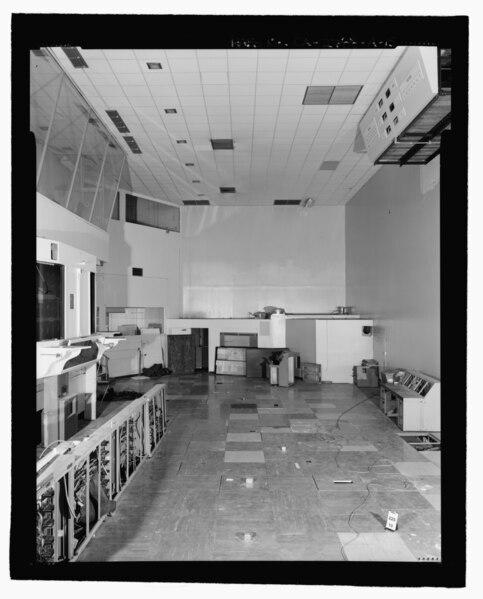
Display area, looking north towards the classified storage rooms, D.M. Logistics and D.O. Offices in northwest corner. Viewing bridge is at upper left, and alert status display at upper right - March Air Force Base, Strategic Air Command, Combat Operations Center, 5220 Riverside Drive, Moreno Valley, Riverside County, CA |
|||
| Depicted place | California; Riverside County; Moreno Valley | |||
| Date | 2002 | |||
| Dimensions | 4 x 5 in. | |||
| Current location |
Library of Congress Prints and Photographs Division Washington, D.C. 20540 USA http://hdl.loc.gov/loc.pnp/pp.print |
|||
| Accession number |
HABS CA-2788-A-15 |
|||
| Credit line |
|
|||
| Notes |
|
|||
| Source | https://www.loc.gov/pictures/item/ca3424.photos.218584p | |||
| Permission (Reusing this file) |
|

| Object location | | View this and other nearby images on: OpenStreetMap |
|---|
File history
Click on a date/time to view the file as it appeared at that time.
| Date/Time | Thumbnail | Dimensions | User | Comment | |
|---|---|---|---|---|---|
| current | 13:06, 7 July 2014 |  | 4,578 × 5,681 (24.81 MB) | Fæ (talk | contribs) | GWToolset: Creating mediafile for Fæ. HABS 05 July 2014 (501:600) |
You cannot overwrite this file.
File usage on Commons
The following page uses this file: