File:District of Terengganu.png
Jump to navigation
Jump to search
No higher resolution available.
District_of_Terengganu.png (367 × 554 pixels, file size: 46 KB, MIME type: image/png)
Captions
Captions
Add a one-line explanation of what this file represents
Summary[edit]
| Description |
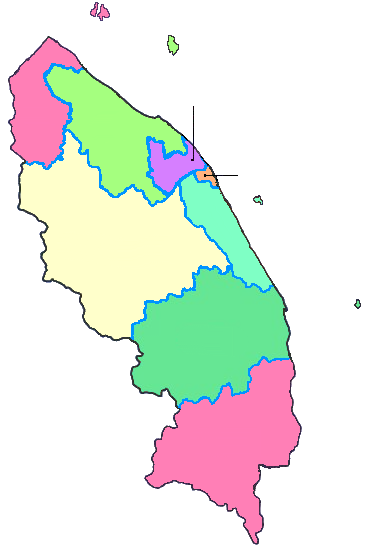
English: District of Terengganu.
Bahasa Melayu: Daerah di Terengganu. |
| Date | |
| Source | Own work |
| Author | Ranking Update |
Licensing[edit]
I, the copyright holder of this work, hereby publish it under the following license:
This file is licensed under the Creative Commons Attribution 3.0 Unported license.
- You are free:
- to share – to copy, distribute and transmit the work
- to remix – to adapt the work
- Under the following conditions:
- attribution – You must give appropriate credit, provide a link to the license, and indicate if changes were made. You may do so in any reasonable manner, but not in any way that suggests the licensor endorses you or your use.
File history
Click on a date/time to view the file as it appeared at that time.
| Date/Time | Thumbnail | Dimensions | User | Comment | |
|---|---|---|---|---|---|
| current | 08:42, 1 June 2013 | | 367 × 554 (46 KB) | Muffin Wizard (talk | contribs) | {{Information |Description ={{en|1=District of Terengganu.}} {{ms|1=Daerah di Terengganu.}} |Source ={{own}} |Author =Ranking Update |Date =2013-06-01 |Permission = |other_versions = }} [[Catego... |
You cannot overwrite this file.
File usage on Commons
There are no pages that use this file.
File usage on other wikis
The following other wikis use this file:
- Usage on en.wikipedia.org
- Usage on ms.wikipedia.org
- Terengganu
- Dungun
- Hulu Terengganu
- Gunung Lawit
- Besut
- Sejarah Terengganu
- Pulau Perhentian
- Kemaman
- Templat:Terengganu
- Selamat Sultan Terengganu
- Daerah Kuala Terengganu
- Pulau Kapas
- Pulau Redang
- Marang
- Setiu
- Kerteh
- Paka
- Kampung Bukit Parit
- Kampung Durian Guling
- Kampung Kelulut
- Kampung Mak Kemas
- Kampung Pantai Merchang
- Kampung Pantai Seberang Marang
- Kampung Paya, Marang
- Kampung Rusila
- Kampung Rhu Rendang
- Kampung Wakaf Tapai, Marang
- Kampung Sungai Kerak
- Sekolah Kebangsaan Marang
- Sekolah Kebangsaan Kerteh
- Seberang Takir
- Kuala Nerus
- Chukai
- Istana Maziah
- Istana Badariah
- Istana Nur Nadhirah
- Kuala Berang
- Kampung Pela Hulu Terengganu
- Kampung Ayer Puteh, Kemaman
- Bandar Seri Bandi
- Sekolah Kebangsaan Pulau Redang
- Kampung Durian Mentangau
- Kampung Landas, Ajil
- Bandar Ketengah Jaya
- Kampung Jerangau
- Kampung Tok Fakir
View more global usage of this file.