File:Dog Bridge, general view looking from the south (standing on the access road) - National Park Seminary, Bounded by Capitol Beltway (I-495), Linden Lane, Woodstove Avenue, and HABS MD,16-SILSPR,2-72.tif
Jump to navigation
Jump to search

Size of this JPG preview of this TIF file: 800 × 584 pixels. Other resolutions: 320 × 234 pixels | 640 × 467 pixels | 1,024 × 748 pixels | 1,280 × 935 pixels | 2,560 × 1,869 pixels | 5,305 × 3,874 pixels.
Original file (5,305 × 3,874 pixels, file size: 19.6 MB, MIME type: image/tiff)
Captions
Captions
Add a one-line explanation of what this file represents
Summary[edit]
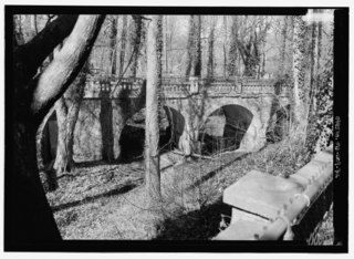
| Dog Bridge, general view looking from the south (standing on the access road) - National Park Seminary, Bounded by Capitol Beltway (I-495), Linden Lane, Woodstove Avenue, and Smith Drive, Silver Spring, Montgomery County, MD | ||||
|---|---|---|---|---|
| Photographer |
Boucher, Jack E. |
|||
| Title |
Dog Bridge, general view looking from the south (standing on the access road) - National Park Seminary, Bounded by Capitol Beltway (I-495), Linden Lane, Woodstove Avenue, and Smith Drive, Silver Spring, Montgomery County, MD |
|||
| Description |
U.S.Department of the Army; Ray, Arthur; Cassedy, John Irving, A; Ament, James E; Davis, Roy Tasco; Holman, Emily Elizabeth; Schneider, Thomas Franklin; Rosenthal, James, field team; Price, Virginia B, transmitter; Ott, Cynthia, historian; Boucher, Jack E, photographer; Lavoie, Catherine C, project manager; Price, Virginia B, transmitter; Price, Virginia B, transmitter |
|||
| Depicted place | Maryland; Montgomery County; Silver Spring | |||
| Date | Documentation compiled after 1933; 2001 | |||
| Dimensions | 5 x 7 in. | |||
| Current location |
Library of Congress Prints and Photographs Division Washington, D.C. 20540 USA http://hdl.loc.gov/loc.pnp/pp.print |
|||
| Accession number |
HABS MD,16-SILSPR,2-72 |
|||
| Credit line |
|
|||
| Notes |
|
|||
| Source | https://www.loc.gov/pictures/item/md1503.photos.216556p | |||
| Permission (Reusing this file) |
|
|||

| Object location | | View this and other nearby images on: OpenStreetMap |
|---|
File history
Click on a date/time to view the file as it appeared at that time.
| Date/Time | Thumbnail | Dimensions | User | Comment | |
|---|---|---|---|---|---|
| current | 20:59, 28 July 2014 |  | 5,305 × 3,874 (19.6 MB) | Fæ (talk | contribs) | GWToolset: Creating mediafile for Fæ. HABS 21 July 2014 (1601:1800) |
You cannot overwrite this file.
File usage on Commons
The following page uses this file: