File:EB9 Pennsylvania.jpg
Jump to navigation
Jump to search

Size of this preview: 800 × 556 pixels. Other resolutions: 320 × 222 pixels | 640 × 445 pixels | 1,024 × 711 pixels | 1,280 × 889 pixels | 2,560 × 1,779 pixels | 5,413 × 3,761 pixels.
Original file (5,413 × 3,761 pixels, file size: 3.97 MB, MIME type: image/jpeg)
Captions
Captions
Add a one-line explanation of what this file represents
| Description |
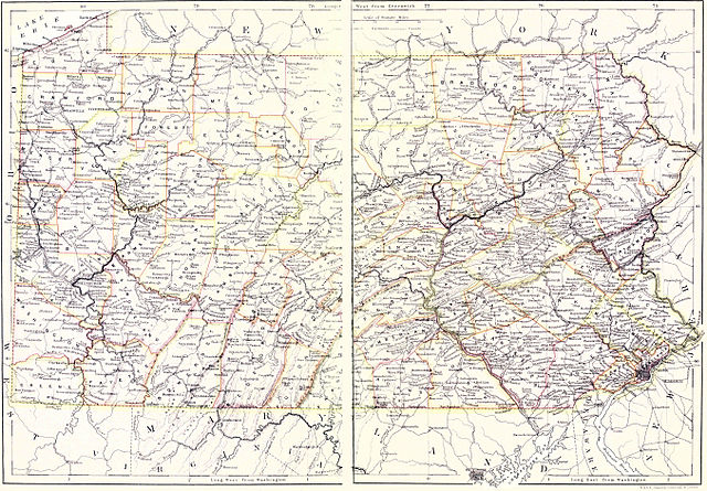
English: Map (mostly political, but with some topography) of Pennsylvania. This graphic is a combination of the contents of the scans of two pages. There is a strip in the middle which represents the missing portion which was inaccessible to the scanner. |
|||
| Date | published 1885 | |||
| Source | Encyclopædia Britannica (9th ed.), v. 18, 1885, between pp. 498 and 499 | |||
| Author | W. & A. K. Johnston, Edinburgh, and London | |||
| Permission (Reusing this file) |
|

File history
Click on a date/time to view the file as it appeared at that time.
| Date/Time | Thumbnail | Dimensions | User | Comment | |
|---|---|---|---|---|---|
| current | 01:42, 26 November 2012 | | 5,413 × 3,761 (3.97 MB) | Bob Burkhardt (talk | contribs) | {{Information |Description={{en|Map (mostly political, but with some topography) of Pennsylvania}} |Source=''Encyclopædia Britannica'' (9th ed.), v. 18, 1885, between pp. 498 and 499 |Date=published 1885 |Author=W. & A. K. Johnston, Edinburgh, and Lon... |
You cannot overwrite this file.
File usage on Commons
There are no pages that use this file.
File usage on other wikis
The following other wikis use this file:
- Usage on en.wikisource.org