File:East elevation without scale. - Armorer's Dwelling House, Northwest side of Shanandoah Street, 400' west of Market Street, Harpers Ferry, Jefferson County, WV HABS WVA,19-HARF,5-7.tif
Jump to navigation
Jump to search

Size of this JPG preview of this TIF file: 800 × 575 pixels. Other resolutions: 320 × 230 pixels | 640 × 460 pixels | 1,024 × 736 pixels | 1,280 × 920 pixels | 2,560 × 1,840 pixels | 5,000 × 3,593 pixels.
Original file (5,000 × 3,593 pixels, file size: 17.14 MB, MIME type: image/tiff)
Captions
Captions
Add a one-line explanation of what this file represents
Summary[edit]
| East elevation without scale. - Armorer's Dwelling House, Northwest side of Shanandoah Street, 400' west of Market Street, Harpers Ferry, Jefferson County, WV | ||||
|---|---|---|---|---|
| Title |
East elevation without scale. - Armorer's Dwelling House, Northwest side of Shanandoah Street, 400' west of Market Street, Harpers Ferry, Jefferson County, WV |
|||
| Description |
Lindstrom, F J, transmitter; Price, Virginia B, transmitter |
|||
| Depicted place | West Virginia; Jefferson County; Harpers Ferry | |||
| Date | Documentation compiled after 1933 | |||
| Dimensions | 5 x 7 in. | |||
| Current location |
Library of Congress Prints and Photographs Division Washington, D.C. 20540 USA http://hdl.loc.gov/loc.pnp/pp.print |
|||
| Accession number |
HABS WVA,19-HARF,5-7 |
|||
| Credit line |
|
|||
| Notes |
|
|||
| Source | https://www.loc.gov/pictures/item/wv0207.photos.172567p | |||
| Permission (Reusing this file) |
|
|||

File history
Click on a date/time to view the file as it appeared at that time.
| Date/Time | Thumbnail | Dimensions | User | Comment | |
|---|---|---|---|---|---|
| current | 07:35, 5 August 2014 | 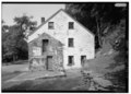 | 5,000 × 3,593 (17.14 MB) | Fæ (talk | contribs) | GWToolset: Creating mediafile for Fæ. HABS 2014-08-04 (3601:3800) Penultimate Tranche! |
You cannot overwrite this file.
File usage on Commons
The following page uses this file: