File:Elder Ballou Meetinghouse, Ballou Meetinghouse Road and West Wrentham Road, Cumberland Hill, Providence County, RI HABS RI,4-CUMB,1- (sheet 0 of 8).tif
Jump to navigation
Jump to search

Size of this JPG preview of this TIF file: 739 × 600 pixels. Other resolutions: 296 × 240 pixels | 592 × 480 pixels | 946 × 768 pixels | 1,262 × 1,024 pixels | 2,523 × 2,048 pixels | 9,344 × 7,584 pixels.
Original file (9,344 × 7,584 pixels, file size: 181 KB, MIME type: image/tiff)
Captions
Captions
Add a one-line explanation of what this file represents
Summary[edit]
| HABS RI,4-CUMB,1- (sheet 0 of 8) - Elder Ballou Meetinghouse, Ballou Meetinghouse Road and West Wrentham Road, Cumberland Hill, Providence County, RI | ||||
|---|---|---|---|---|
| Title |
HABS RI,4-CUMB,1- (sheet 0 of 8) - Elder Ballou Meetinghouse, Ballou Meetinghouse Road and West Wrentham Road, Cumberland Hill, Providence County, RI |
|||
| Depicted place | Rhode Island; Providence County; Cumberland Hill | |||
| Date | Documentation compiled after 1933 | |||
| Dimensions | 19 x 24 in. (B size) | |||
| Current location |
Library of Congress Prints and Photographs Division Washington, D.C. 20540 USA http://hdl.loc.gov/loc.pnp/pp.print |
|||
| Accession number |
HABS RI,4-CUMB,1- (sheet 0 of 8) |
|||
| Credit line |
|
|||
| Notes |
The 1971 HABS catalogue noted that the building had a three-bay facade and a center entrance that faced the pulpit and elders bench. The building burned around 1962.
|
|||
| Source | https://www.loc.gov/pictures/item/ri0104.sheet.00000a | |||
| Permission (Reusing this file) |
|
|||
| Other versions |
.png) .png) .png) .png) .png) .png) .png) .png) .png) |
|||

| Object location | | View this and other nearby images on: OpenStreetMap |
|---|
File history
Click on a date/time to view the file as it appeared at that time.
| Date/Time | Thumbnail | Dimensions | User | Comment | |
|---|---|---|---|---|---|
| current | 17:40, 1 August 2014 | 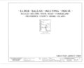 | 9,344 × 7,584 (181 KB) | Fæ (talk | contribs) | GWToolset: Creating mediafile for Fæ. HABS 31 July 2014 (3000:3200) |
You cannot overwrite this file.
File usage on Commons
The following page uses this file: