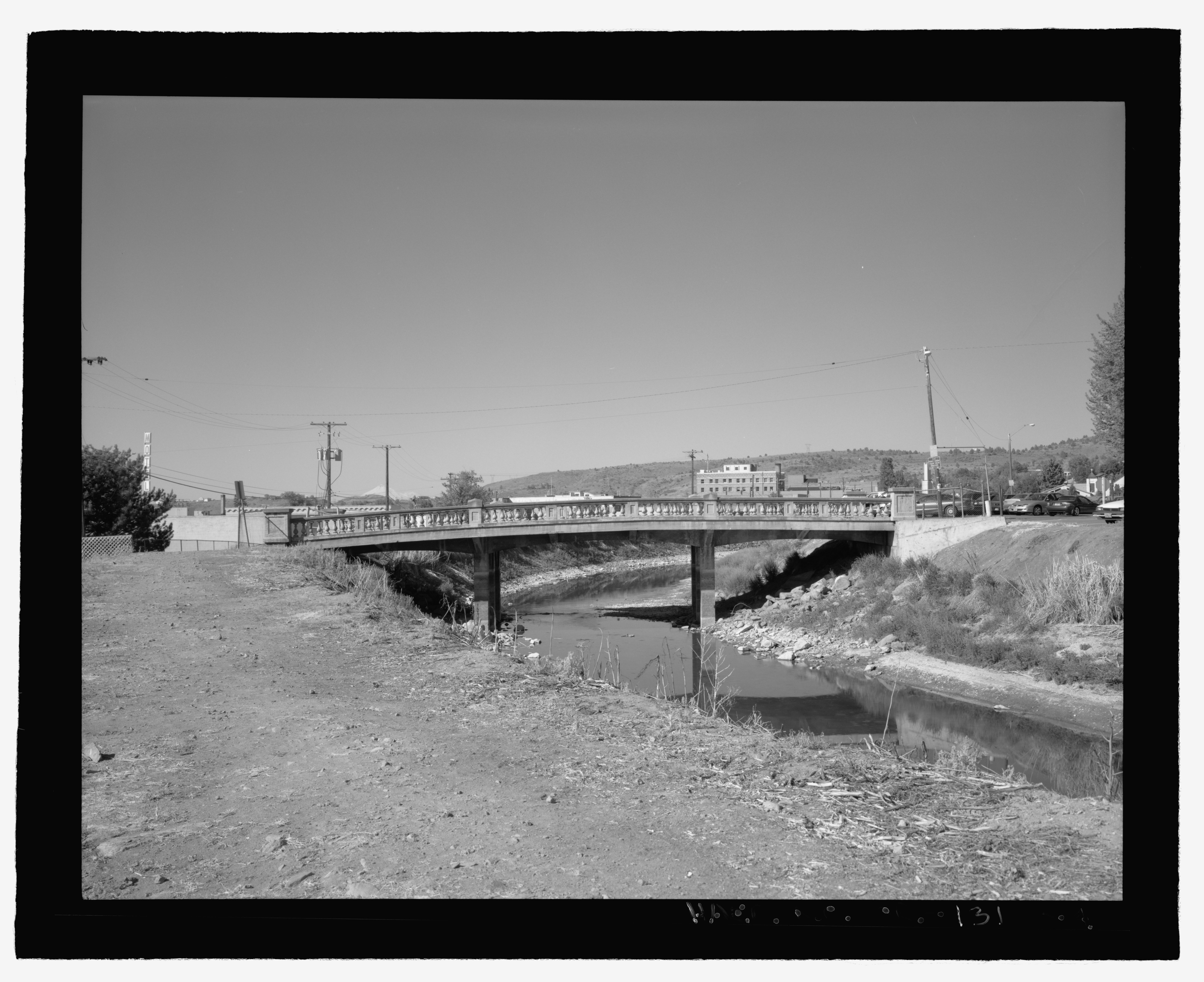
File:Elevation view of the A Canal Bridge, view looking west - A Canal Bridge, Spanning the A Canal on Wall Street, Klamath Falls, Klamath County, OR HAER OR-131-4.tif
Jump to navigation
Jump to search

Size of this JPG preview of this TIF file: 735 × 599 pixels. Other resolutions: 294 × 240 pixels | 589 × 480 pixels | 942 × 768 pixels | 1,256 × 1,024 pixels | 2,512 × 2,048 pixels | 5,607 × 4,572 pixels.
Original file (5,607 × 4,572 pixels, file size: 24.45 MB, MIME type: image/tiff)
Captions
Captions
Add a one-line explanation of what this file represents
Summary[edit]
| Elevation view of the A Canal Bridge, view looking west - A Canal Bridge, Spanning the A Canal on Wall Street, Klamath Falls, Klamath County, OR | ||||
|---|---|---|---|---|
| Photographer |
Schwab, Leslie Related names:
|
|||
| Title |
Elevation view of the A Canal Bridge, view looking west - A Canal Bridge, Spanning the A Canal on Wall Street, Klamath Falls, Klamath County, OR |
|||
| Depicted place | Oregon; Klamath County; Klamath Falls | |||
| Date | 2001 | |||
| Dimensions | 4 x 5 in. | |||
| Current location |
Library of Congress Prints and Photographs Division Washington, D.C. 20540 USA http://hdl.loc.gov/loc.pnp/pp.print |
|||
| Accession number |
HAER OR-131-4 |
|||
| Credit line |
|
|||
| Notes |
|
|||
| Source | https://www.loc.gov/pictures/item/or0511.photos.220330p | |||
| Permission (Reusing this file) |
|
|||

| Object location | | View this and other nearby images on: OpenStreetMap |
|---|
File history
Click on a date/time to view the file as it appeared at that time.
| Date/Time | Thumbnail | Dimensions | User | Comment | |
|---|---|---|---|---|---|
| current | 10:58, 2 August 2014 |  | 5,607 × 4,572 (24.45 MB) | Fæ (talk | contribs) | GWToolset: Creating mediafile for Fæ. HABS 2014-08-01 2601-2900 missing |
You cannot overwrite this file.
File usage on Commons
The following page uses this file: