File:Fargo, North Dakota Red River.jpg
Jump to navigation
Jump to search
Size of this preview: 800 × 536 pixels. Other resolutions: 320 × 214 pixels | 640 × 428 pixels | 1,024 × 685 pixels | 1,280 × 857 pixels | 2,560 × 1,714 pixels | 3,872 × 2,592 pixels.
Original file (3,872 × 2,592 pixels, file size: 3.89 MB, MIME type: image/jpeg)
Captions
Captions
Add a one-line explanation of what this file represents
Summary[edit]
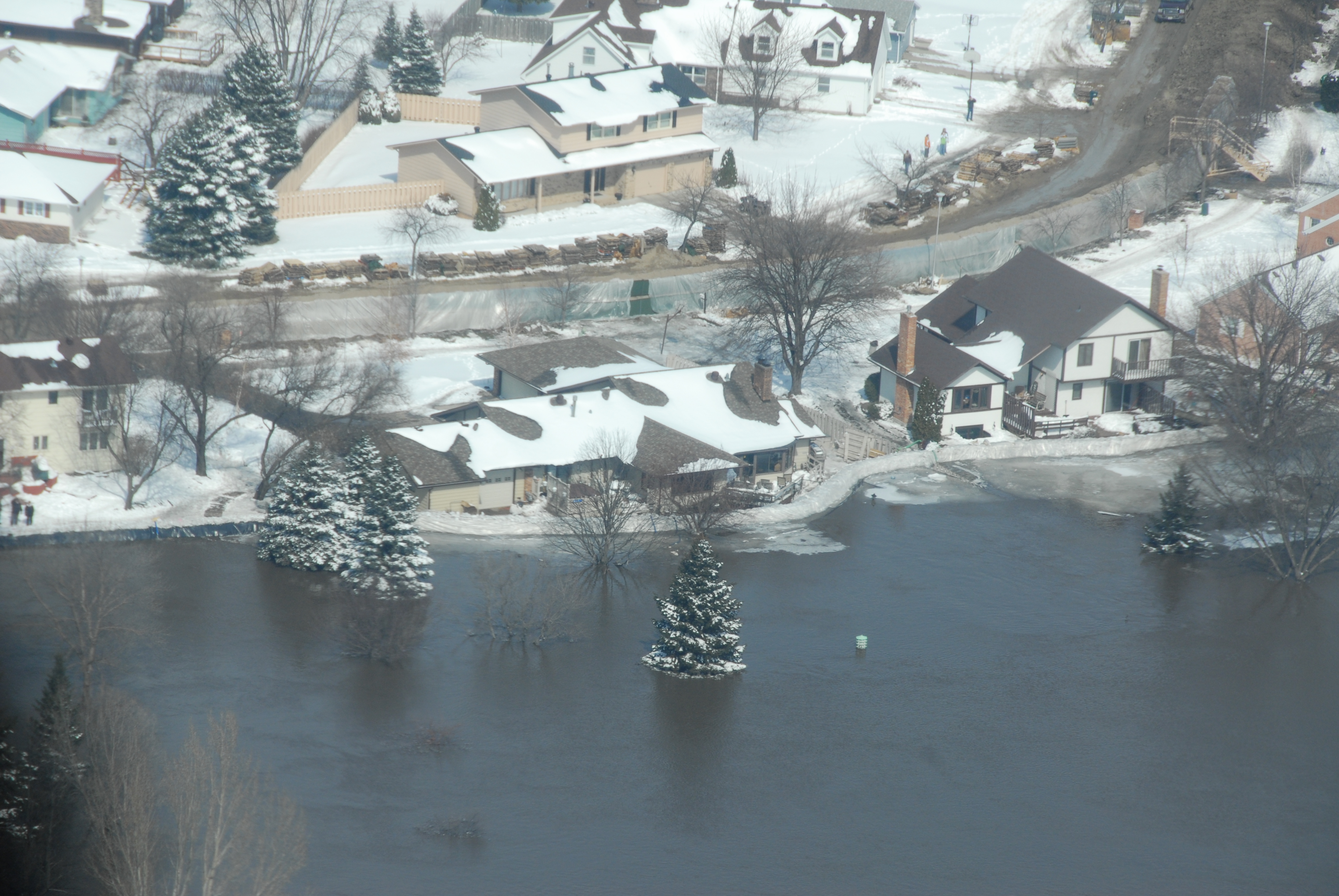
| Description | An aerial view of rising waters of the Red River from east to west is shown in south Fargo, N.D., March 28, 2009. A sandbag dike lines the river as well as a contingency dike created to block the advancement of water in the event of a dike failure. The rising flood waters of the Red River on the North Dakota and Minnesota border are at the highest level ever recorded in the Fargo and Moorhead, Minn., area. USNORTHCOM is coordinating DoD support to civil authorities conducting disaster relief efforts in Minnesota and North Dakota as ordered by the President or the Secretary of Defense. |
| Date | |
| Source | http://www.northcom.mil/Images/Images_2009/090328-F-0681L-154.jpg |
| Author | Photo by Senior Master Sgt. David H. Lipp |
Licensing[edit]
This work is in the public domain in the United States because it is a work prepared by an officer or employee of the United States Government as part of that person’s official duties under the terms of Title 17, Chapter 1, Section 105 of the US Code.
Note: This only applies to original works of the Federal Government and not to the work of any individual U.S. state, territory, commonwealth, county, municipality, or any other subdivision. This template also does not apply to postage stamp designs published by the United States Postal Service since 1978. (See § 313.6(C)(1) of Compendium of U.S. Copyright Office Practices). It also does not apply to certain US coins; see The US Mint Terms of Use.
|
 | |
| This file has been identified as being free of known restrictions under copyright law, including all related and neighboring rights. | ||
File history
Click on a date/time to view the file as it appeared at that time.
| Date/Time | Thumbnail | Dimensions | User | Comment | |
|---|---|---|---|---|---|
| current | 21:58, 9 January 2010 | | 3,872 × 2,592 (3.89 MB) | Wikifreund (talk | contribs) | {{Information |Description=An aerial view of rising waters of the Red River from east to west is shown in south Fargo, N.D., March 28, 2009. A sandbag dike lines the river as well as a contingency dike created to block the advancement of water in the even |
You cannot overwrite this file.
File usage on Commons
There are no pages that use this file.
File usage on other wikis
The following other wikis use this file:
- Usage on de.wikipedia.org