File:Footpath above Pwll Du quarry - geograph.org.uk - 498348.jpg
Jump to navigation
Jump to search
No higher resolution available.
Footpath_above_Pwll_Du_quarry_-_geograph.org.uk_-_498348.jpg (640 × 480 pixels, file size: 174 KB, MIME type: image/jpeg)
Captions
Captions
Add a one-line explanation of what this file represents
Summary[edit]
| Description |
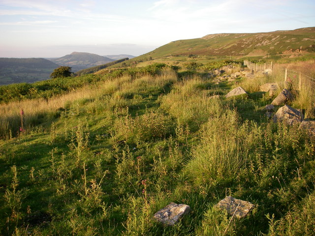
English: Footpath above Pwll Du quarry This path crosses rough grazing above the abandoned limestone quarry. The north-western flanks of Blorenge are seen in the middle distance and Ysgyryd /Skirrid Fawr in the far distance. The path follows what was probably one of Thomas Hill's early tramways (c 1820) linking Pwll Du quarries and the Gilwern Hill quarries round the head of Cwm Llanwenarth to Garn Ddyrys and eventually Llanfoist Wharf on the canal below. |
| Date | |
| Source | From geograph.org.uk |
| Author | Alan Bowring |
| Attribution (required by the license) | Alan Bowring / Footpath above Pwll Du quarry / |
| Camera location | | View this and other nearby images on: OpenStreetMap |
|---|
_heading:67.00&language=en)
| Object location | | View this and other nearby images on: OpenStreetMap |
|---|
_heading:67.00&language=en)
Licensing[edit]

|
This image was taken from the Geograph project collection. See this photograph's page on the Geograph website for the photographer's contact details. The copyright on this image is owned by Alan Bowring and is licensed for reuse under the Creative Commons Attribution-ShareAlike 2.0 license.
|
This file is licensed under the Creative Commons Attribution-Share Alike 2.0 Generic license.
Attribution: Alan Bowring
- You are free:
- to share – to copy, distribute and transmit the work
- to remix – to adapt the work
- Under the following conditions:
- attribution – You must give appropriate credit, provide a link to the license, and indicate if changes were made. You may do so in any reasonable manner, but not in any way that suggests the licensor endorses you or your use.
- share alike – If you remix, transform, or build upon the material, you must distribute your contributions under the same or compatible license as the original.
File history
Click on a date/time to view the file as it appeared at that time.
| Date/Time | Thumbnail | Dimensions | User | Comment | |
|---|---|---|---|---|---|
| current | 04:57, 5 February 2011 | | 640 × 480 (174 KB) | GeographBot (talk | contribs) | == {{int:filedesc}} == {{Information |description={{en|1=Footpath above Pwll Du quarry This path crosses rough grazing above the abandoned limestone quarry. The north-western flanks of Blorenge are seen in the middle distance and Ysgyryd /Skirrid Fawr in |
You cannot overwrite this file.
File usage on Commons
There are no pages that use this file.