File:Fort Dearborn 1808.jpg
Jump to navigation
Jump to search
Size of this preview: 419 × 600 pixels. Other resolutions: 168 × 240 pixels | 335 × 480 pixels | 536 × 768 pixels | 715 × 1,024 pixels | 1,600 × 2,290 pixels.
Original file (1,600 × 2,290 pixels, file size: 940 KB, MIME type: image/jpeg)
Captions
Captions
Add a one-line explanation of what this file represents
Summary[edit]
| Description |
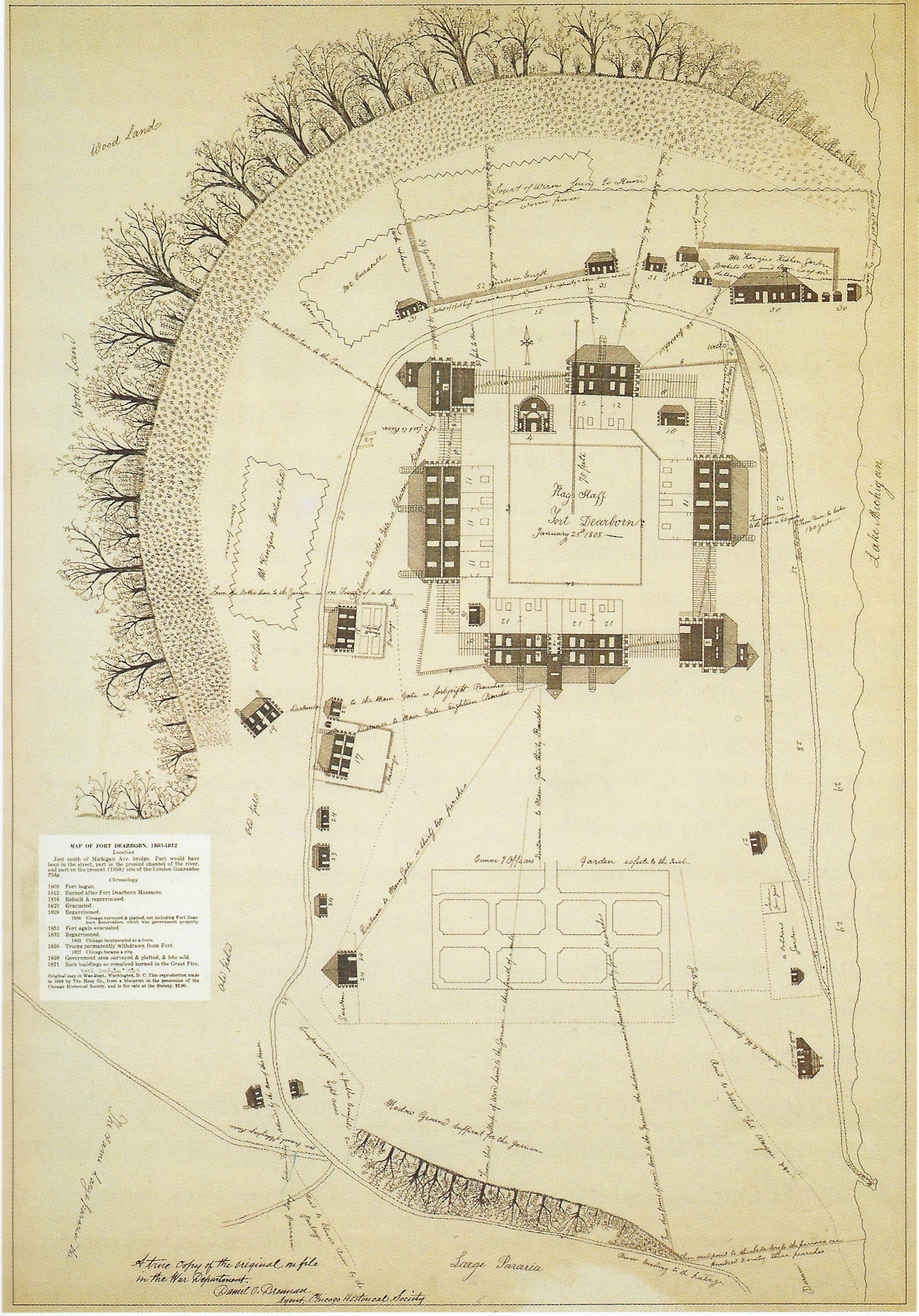
English: Map of Fort Dearborn in January 1808 by Captain John Whistler, commandant of the fort. |
| Date | |
| Source | Scanned by User:JeremyA from Holland, Robert A. (2005) "Chicago in Maps, 1612 to 2002" |
| Author | John Whistler (1756–1829) |
| Permission (Reusing this file) |
Public domain: 1—it is a work of the United States Federal Government; 2—the author died more than 100 years ago; 3—the map was first published in the United States before 1923 |
Licensing[edit]
|
This work is in the public domain in its country of origin and other countries and areas where the copyright term is the author's life plus 100 years or fewer. | |
| This file has been identified as being free of known restrictions under copyright law, including all related and neighboring rights. | |
File history
Click on a date/time to view the file as it appeared at that time.
| Date/Time | Thumbnail | Dimensions | User | Comment | |
|---|---|---|---|---|---|
| current | 00:42, 19 April 2011 | | 1,600 × 2,290 (940 KB) | JeremyA (talk | contribs) | {{Information |Description ={{en|1=Map of Fort Dearborn in January 1808 by Captain John Whistler, commandant of the fort.}} |Source =Scanned by User:JeremyA from Holland, Robert A. (2005) "Chicago in Maps, 1612 to 2002" |Author =John Wh |
You cannot overwrite this file.
File usage on Commons
The following page uses this file:
File usage on other wikis
The following other wikis use this file:
- Usage on en.wikipedia.org
- Usage on es.wikipedia.org
- Usage on fa.wikipedia.org
- Usage on fr.wikipedia.org
- Usage on ja.wikipedia.org
- Usage on zh.wikipedia.org