File:Fort Dunlop under development.jpg
Jump to navigation
Jump to search

Size of this preview: 800 × 462 pixels. Other resolutions: 320 × 185 pixels | 640 × 370 pixels | 1,223 × 707 pixels.
Original file (1,223 × 707 pixels, file size: 131 KB, MIME type: image/jpeg)
Captions
Captions
Add a one-line explanation of what this file represents
| Description |
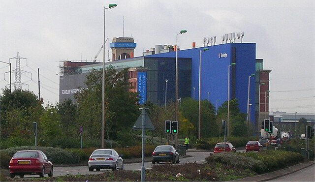
English: Fort Dunlop on the A47 Fort Parkway, four miles north east of Birmingham, England. Under development into a Travelodge hotel (the blue end), and offices. The distinctive turrets of the 'fort' are at the far end and shrouded. They were a prominent feature seen from the M6 motorway when traveling eastwards. Photographed by me 12 October 2006. Oosoom |
||
| Date | 13 October 2006 (original upload date) | ||
| Source | Transferred from en.wikipedia | ||
| Author | Original uploader was Oosoom at en.wikipedia | ||
| Permission (Reusing this file) |
I, the copyright holder of this work, hereby publish it under the following licenses:
This file is licensed under the Creative Commons Attribution-Share Alike 3.0 Unported license.
You may select the license of your choice. |

| Camera location | | View this and other nearby images on: OpenStreetMap |
|---|
Original upload log[edit]
The original description page was here. All following user names refer to en.wikipedia.
- 2006-10-13 09:43 Oosoom 1223×707×8 (133907 bytes) [[Fort Dunlop]] on the [[A47 road|A47]] Fort Parkway, four miles north east of [[Birmingham]], England. Under development into a [[Travelodge]] hotel (the blue end), and offices. The distinctive turrets of the 'fort' are at the far end and shrouded. They
File history
Click on a date/time to view the file as it appeared at that time.
| Date/Time | Thumbnail | Dimensions | User | Comment | |
|---|---|---|---|---|---|
| current | 09:38, 11 June 2008 | | 1,223 × 707 (131 KB) | Oosoom (talk | contribs) | {{Information |Description={{en|Fort Dunlop on the A47 Fort Parkway, four miles north east of Birmingham, England. Under development into a Travelodge hotel (the blue end), and off |
You cannot overwrite this file.
File usage on Commons
The following page uses this file:
File usage on other wikis
The following other wikis use this file:
- Usage on en.wikipedia.org
- Usage on www.wikidata.org