File:Four corners.jpg
Jump to navigation
Jump to search
Size of this preview: 465 × 599 pixels. Other resolutions: 186 × 240 pixels | 372 × 480 pixels | 596 × 768 pixels | 794 × 1,024 pixels | 1,589 × 2,048 pixels | 4,500 × 5,800 pixels.
Original file (4,500 × 5,800 pixels, file size: 4.33 MB, MIME type: image/jpeg)
Captions
Captions
Add a one-line explanation of what this file represents
Summary[edit]
| Description |
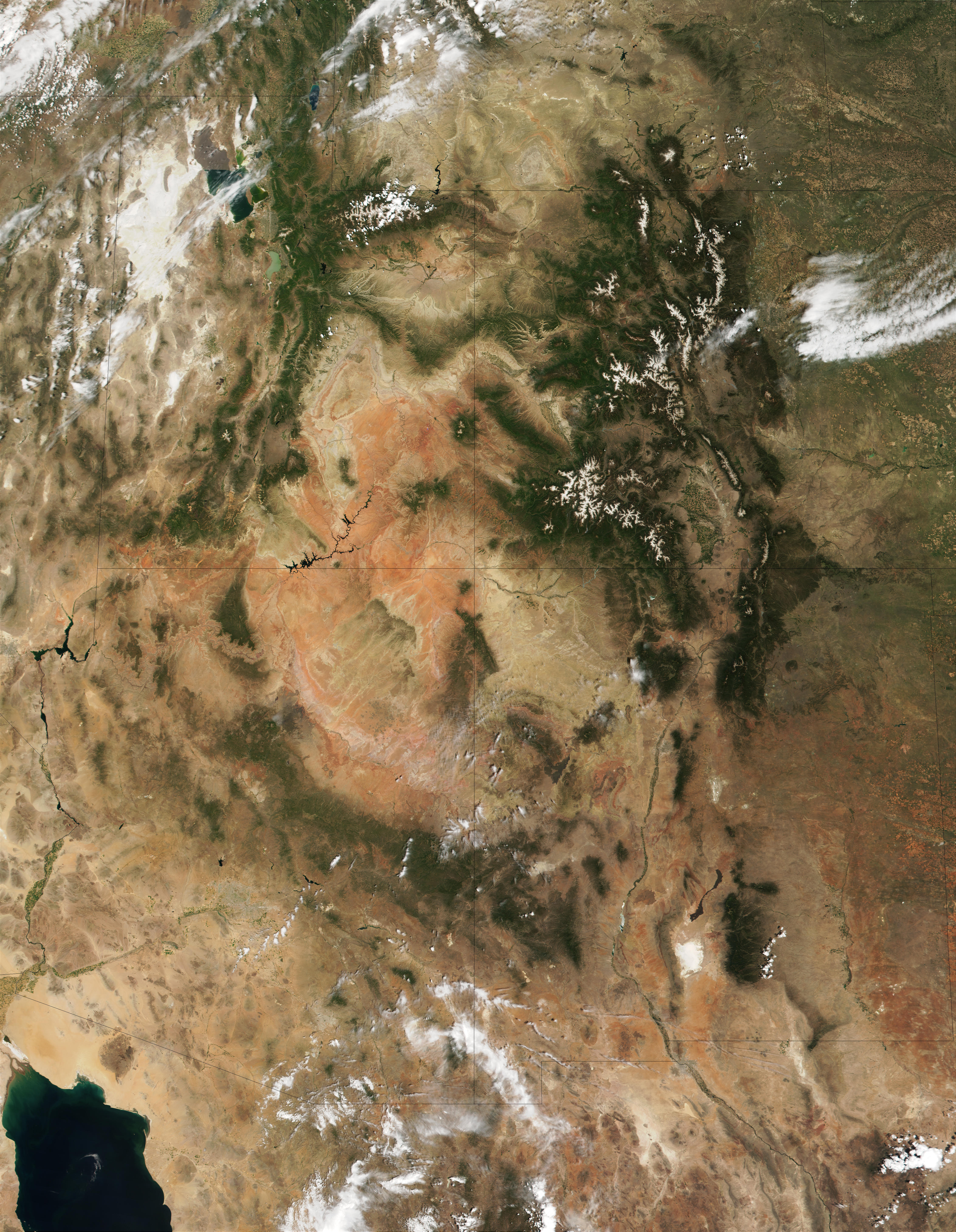
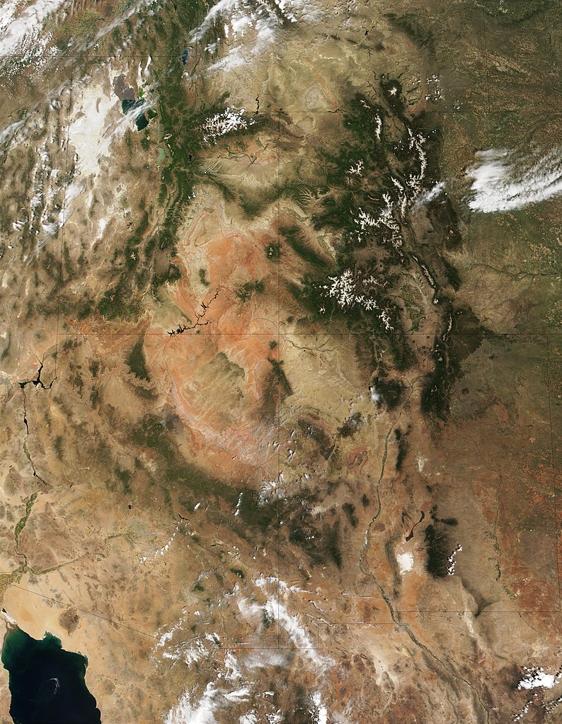
English: This MODIS true-color image is centered on the Four Corners region in the Southwest United States. Recognizable features include the forest-covered Rocky Mountains, which still have snow-covered peaks, running through Colorado and into New Mexico. To the west of Colorado is Utah, where the Great Salt Lake can be seen at the upper left. The Colorado Plateau, with its salmon-colored rocks, extends south from Utah into Arizona. The Grand Canyon of the Colorado River cuts westward through the mountains in northern Arizona. |
| Date | |
| Source | http://visibleearth.nasa.gov/view_rec.php?id=1980 |
| Author | Jacques Descloitres, MODIS Land Rapid Response Team (NASA) |
Licensing[edit]
| This file is in the public domain in the United States because it was solely created by NASA. NASA copyright policy states that "NASA material is not protected by copyright unless noted". (See Template:PD-USGov, NASA copyright policy page or JPL Image Use Policy.) | ||
 |
Warnings:
|
File history
Click on a date/time to view the file as it appeared at that time.
| Date/Time | Thumbnail | Dimensions | User | Comment | |
|---|---|---|---|---|---|
| current | 11:53, 20 December 2010 | | 4,500 × 5,800 (4.33 MB) | Orionist (talk | contribs) | high res from original source |
| 13:32, 23 February 2005 |  | 396 × 511 (187 KB) | Complex01 (talk | contribs) |
You cannot overwrite this file.
File usage on Commons
The following page uses this file:
File usage on other wikis
The following other wikis use this file:
- Usage on ar.wikipedia.org
- Usage on az.wikipedia.org
- Usage on bg.wikipedia.org
- Usage on bn.wikipedia.org
- Usage on bs.wikipedia.org
- Usage on ckb.wikipedia.org
- Usage on en.wikipedia.org
- Usage on es.wikipedia.org
- Usage on et.wikipedia.org
- Usage on fa.wikipedia.org
- Usage on fi.wikipedia.org
- Usage on he.wikipedia.org
- Usage on hu.wikipedia.org
- Usage on it.wikipedia.org
- Usage on ja.wikipedia.org
- Usage on ka.wikipedia.org
- Usage on kk.wikipedia.org
- Usage on kn.wikipedia.org
- Usage on ko.wikipedia.org
- Usage on lfn.wikipedia.org
- Usage on lt.wikipedia.org
- Usage on mk.wikipedia.org
- Usage on ml.wikipedia.org
- Usage on nl.wikipedia.org
- Usage on pa.wikipedia.org
- Usage on pl.wikipedia.org
- Usage on pnb.wikipedia.org
- Usage on pt.wikipedia.org
- Usage on ru.wikipedia.org
- Usage on si.wikipedia.org
- Usage on sq.wikipedia.org
- Usage on ta.wikipedia.org
- Usage on vi.wikipedia.org
- Usage on zh.wikipedia.org