File:GARAGE INTERIOR SHOWING UNFINISHED WOOD FRAME CONSTRUCTION AND CASEMENT WINDOW THROUGH REAR WALL. VIEW TO SOUTH - Big Creek Hydroelectric System, Big Creek Town, Operator HAER CAL,10-BICRK.V,1D-3.tif
Jump to navigation
Jump to search

Size of this JPG preview of this TIF file: 487 × 600 pixels. Other resolutions: 195 × 240 pixels | 390 × 480 pixels | 624 × 768 pixels | 832 × 1,024 pixels | 1,663 × 2,048 pixels | 4,516 × 5,560 pixels.
Original file (4,516 × 5,560 pixels, file size: 23.95 MB, MIME type: image/tiff)
Captions
Captions
Add a one-line explanation of what this file represents
Summary[edit]
| Photographer |
O'Loughlin, Gregory L. Related names:
|
|||
| Title |
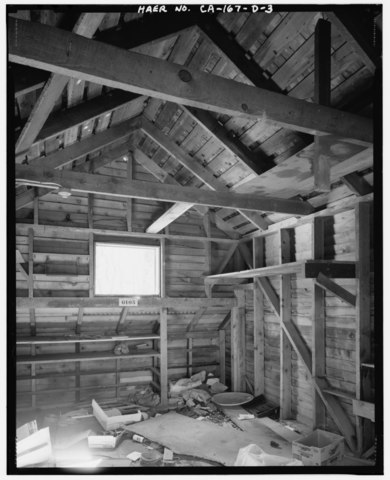
GARAGE INTERIOR SHOWING UNFINISHED WOOD FRAME CONSTRUCTION AND CASEMENT WINDOW THROUGH REAR WALL. VIEW TO SOUTH - Big Creek Hydroelectric System, Big Creek Town, Operator House Garage, Orchard Avenue south of Huntington Lake Road, Big Creek, Fresno County, CA |
|||
| Depicted place | California; Fresno County; Big Creek | |||
| Date | 2000 | |||
| Dimensions | 4 x 5 in. | |||
| Current location |
Library of Congress Prints and Photographs Division Washington, D.C. 20540 USA http://hdl.loc.gov/loc.pnp/pp.print |
|||
| Accession number |
HAER CAL,10-BICRK.V,1D-3 |
|||
| Credit line |
|
|||
| Notes |
|
|||
| Source | https://www.loc.gov/pictures/item/ca3004.photos.382194p | |||
| Permission (Reusing this file) |
|

| Camera location | | View this and other nearby images on: OpenStreetMap |
|---|
File history
Click on a date/time to view the file as it appeared at that time.
| Date/Time | Thumbnail | Dimensions | User | Comment | |
|---|---|---|---|---|---|
| current | 02:54, 6 July 2014 |  | 4,516 × 5,560 (23.95 MB) | Fæ (talk | contribs) | GWToolset: Creating mediafile for Fæ. HABS 05 July 2014 (501:600) |
You cannot overwrite this file.
File usage on Commons
The following page uses this file: