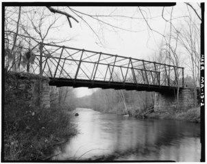
File:GENERAL VIEW SHOWING TRUSS AND MASONRY ABUTMENTS, LOOKING DOWNSTREAM - Ponakin Road Bridge, Spanning Nashua River on Ponakin Road, Lancaster, Worcester County, MA HAER MASS,14-LANC.V,2-2.tif
Jump to navigation
Jump to search

Size of this JPG preview of this TIF file: 754 × 600 pixels. Other resolutions: 302 × 240 pixels | 603 × 480 pixels | 965 × 768 pixels | 1,280 × 1,018 pixels | 2,560 × 2,037 pixels | 5,000 × 3,978 pixels.
Original file (5,000 × 3,978 pixels, file size: 18.97 MB, MIME type: image/tiff)
Captions
Captions
Add a one-line explanation of what this file represents
Summary[edit]
| GENERAL VIEW SHOWING TRUSS AND MASONRY ABUTMENTS, LOOKING DOWNSTREAM - Ponakin Road Bridge, Spanning Nashua River on Ponakin Road, Lancaster, Worcester County, MA | ||||
|---|---|---|---|---|
| Title |
GENERAL VIEW SHOWING TRUSS AND MASONRY ABUTMENTS, LOOKING DOWNSTREAM - Ponakin Road Bridge, Spanning Nashua River on Ponakin Road, Lancaster, Worcester County, MA |
|||
| Description |
Post , Simeon S; Watson Manufacturing Company; Thayer, Nathaniel; Wilder, Charles L; Parker, George A; Thissle, Joshua; Post, Andrew J; Jackson, Donald C, transmitter; Massachusetts Department of Public Works, sponsor; Massachusetts Historical Commission, sponsor; Garvey, Jane F, sponsor; Turner, George R, sponsor; Roper, Stephen J, sponsor; Kapsch, Robert J, sponsor; Fitzgerald, Ella, sponsor; Delony, Eric, project manager; Lowe, Jet, photographer; Stupich, Martin, photographer; Hawley, Monica E, historian; Harshbarger, Patrick, historian; Schodek, Daniel L, delineator; Reese, Patricia, delineator; Kleinschmidt, Gary C, delineator; Payne, Chris, delineator; Fleisig, Morgan, delineator; Rowan, Mark, delineator; Sosef, Rudolph J, A, delineator; Bennett, Lola, historian; Healy, John, historian; Debnam, Albert N, delineator |
|||
| Depicted place | Massachusetts; Worcester County; Lancaster | |||
| Date | Documentation compiled after 1968 | |||
| Dimensions | 4 x 5 in. | |||
| Current location |
Library of Congress Prints and Photographs Division Washington, D.C. 20540 USA http://hdl.loc.gov/loc.pnp/pp.print |
|||
| Accession number |
HAER MASS,14-LANC.V,2-2 |
|||
| Credit line |
|
|||
| Notes |
|
|||
| References |
|
|||
| Source | https://www.loc.gov/pictures/item/ma1172.photos.077136p | |||
| Permission (Reusing this file) |
|
|||

| Object location | | View this and other nearby images on: OpenStreetMap |
|---|
File history
Click on a date/time to view the file as it appeared at that time.
| Date/Time | Thumbnail | Dimensions | User | Comment | |
|---|---|---|---|---|---|
| current | 18:24, 21 July 2014 |  | 5,000 × 3,978 (18.97 MB) | Fæ (talk | contribs) | GWToolset: Creating mediafile for Fæ. HABS 20 July 2014 (1401:1600) |
You cannot overwrite this file.
File usage on Commons
The following page uses this file: