File:Germany location map.svg

Archivo original (archivo SVG, nominalmente 1073 × 1272 píxeles, tamaño de archivo: 452 kB)
Leyendas
Leyendas
Resumen
| Descripción |
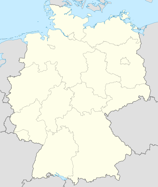
Quadratische Plattkarte, N-S-Streckung 150 %. Geographische Begrenzung der Karte:
Equirectangular projection, N/S stretching 150 %. Geographic limits of the map:
Français : Carte de l'Allemagne |
||
| Fecha | |||
| Fuente | Trabajo propio, using United States National Imagery and Mapping Agency data | ||
| Autor | NordNordWest | ||
| Otras versiones |
Obras derivadas de ésta:
Bundesrepublik Deutschland (vor 1990 nur West-Deutschland):
Deutsche Demokratische Republik (mit BRD im Ausschnitt):
Ostdeutschland (vor 1990 Deutsche Demokratische Republik):
Deutschland zwischen Mai 1945 und Oktober 1949:
Thematisch:
Deutsches Reich (1918–1945) (best used with this template (de)):
|
||
| SVG desarrollo | Este mapa, inválido según el W3C, fue creado con Adobe Illustrator
|


_23_May_1949_-_6_Oct_1949.svg)


_location_map.svg)
_location_map_2013.svg)


_location_map.svg)
Licencia

|
Se autoriza la copia, distribución y modificación de este documento bajo los términos de la licencia de documentación libre GNU, versión 1.2 o cualquier otra que posteriormente publique la Fundación para el Software Libre; sin secciones invariables, textos de portada, ni textos de contraportada. Se incluye una copia de la dicha licencia en la sección titulada Licencia de Documentación Libre GNU. |
- Eres libre:
- de compartir – de copiar, distribuir y transmitir el trabajo
- de remezclar – de adaptar el trabajo
- Bajo las siguientes condiciones:
- atribución – Debes otorgar el crédito correspondiente, proporcionar un enlace a la licencia e indicar si realizaste algún cambio. Puedes hacerlo de cualquier manera razonable pero no de manera que sugiera que el licenciante te respalda a ti o al uso que hagas del trabajo.
- compartir igual – En caso de mezclar, transformar o modificar este trabajo, deberás distribuir el trabajo resultante bajo la misma licencia o una compatible como el original.
Historial del archivo
Haz clic sobre una fecha y hora para ver el archivo tal como apareció en ese momento.
| Fecha y hora | Miniatura | Dimensiones | Usuario | Comentario | |
|---|---|---|---|---|---|
| actual | 12:51 16 sep 2013 | | 1073 × 1272 (452 kB) | SokoWiki (discusión | contribs.) | Clearer borders. |
| 08:34 16 sep 2013 |  | 1073 × 1272 (452 kB) | NordNordWest (discusión | contribs.) | Reverted to version as of 12:32, 2 October 2012; didn't make anything better | |
| 08:34 16 sep 2013 |  | 1073 × 1272 (452 kB) | NordNordWest (discusión | contribs.) | Reverted to version as of 12:32, 2 October 2012; didn't make anything better | |
| 20:08 15 sep 2013 |  | 1073 × 1272 (451 kB) | SokoWiki (discusión | contribs.) | * | |
| 12:32 2 oct 2012 |  | 1073 × 1272 (452 kB) | Palosirkka (discusión | contribs.) | Reverted to version as of 20:14, 5 August 2012 Location maps must remain very accurate | |
| 05:40 2 oct 2012 |  | 1073 × 1272 (396 kB) | Palosirkka (discusión | contribs.) | Scrubbed with http://codedread.com/scour/ | |
| 20:14 5 ago 2012 |  | 1073 × 1272 (452 kB) | NordNordWest (discusión | contribs.) | upd | |
| 10:03 19 ene 2010 |  | 1073 × 1272 (490 kB) | NordNordWest (discusión | contribs.) | update | |
| 08:33 22 jul 2009 |  | 1075 × 1273 (608 kB) | NordNordWest (discusión | contribs.) | c | |
| 14:36 13 oct 2008 |  | 1075 × 1273 (606 kB) | NordNordWest (discusión | contribs.) |
No puedes sobrescribir este archivo.
Usos del archivo
Hay más de 100 páginas que usan este archivo. La lista siguiente sólo muestra las primeras 100 páginas que usan este archivo. También puedes consultar la lista completa.
- Bad Hersfeld
- Bad Honnef
- Billigheim
- Bornheim (Rheinland)
- Deutschland
- Eitorf
- Helmstedt
- Hennef (Sieg)
- Info:Kusterdingen
- Info:Mössingen
- Kusterdingen
- Mosbach
- Nentershausen
- Oberpleis
- Ruppichteroth
- Wilhelmsstift Tübingen
- User:Daniel Mietchen/Category:Images used by media organizations but violating license terms
- User:NordNordWest/Gallery/Location maps
- User:PMMKALYAN
- User:Sekamor
- User talk:Mmh
- User talk:NordNordWest/Archive
- User talk:Sting/Archive 01
- Commons:Overwriting existing files
- Commons:Overwriting existing files/cs
- Commons:Overwriting existing files/de
- Commons:Overwriting existing files/en
- Commons:Overwriting existing files/fr
- Commons:Overwriting existing files/ja
- Commons:Overwriting existing files/pl
- Commons:Overwriting existing files/ru
- Commons talk:Project Mapmaking Wiki Standards
- File:Ambulante Kinderhospizdienste in Deutschland.PNG
- File:Auerbach (Karlsbad) location map.svg
- File:Bahnhoefe Wuerzburg.png
- File:Dat-das-Linie.png
- File:Deutschland.svg
- File:Deutschland Autobahnen.svg
- File:Deutschland Lage von Baden.svg
- File:Deutschland Lage von Württemberg-Baden.svg
- File:Deutschland Lage von Württemberg-Hohenzollern.svg
- File:East-West-Germany-October 1949-July 1952.svg
- File:East Germany location map.svg
- File:Germany, Federal Republic of location map 23 May 1949 - 6 Oct 1949.svg
- File:Germany, Federal Republic of location map April 1952 - August 1955.svg
- File:Germany, Federal Republic of location map December 1950 - April 1952.svg
- File:Germany, Federal Republic of location map January 1957 - October 1990.svg
- File:Germany, Federal Republic of location map October 1949 - November 1950.svg
- File:Germany, Federal Republic of location map September 1955 - December 1956.svg
- File:Germany, German Democratic Republic location map January 1957 - October 1990.svg
- File:Germany, German Democratic Republic location map July 1952 - January 1957.svg
- File:Germany, German Democratic Republic location map October 1949 - July 1952.svg
- File:Germany, German Democratic Republic location map w·o FRG July 1952 - October 1990.svg
- File:Germany, German Democratic Republic location map w·o FRG October 1949 - June 1952.svg
- File:Germany, location map (SBZ perspective) 23 May 1949 - 6 Oct 1949.svg
- File:Germany2 location map.svg
- File:Germany (+districts +municipalities) location map.png
- File:Germany (+districts +municipalities) location map current.svg
- File:Germany Eishockey Oberliga 2008-09.svg
- File:Germany location map-bundesliga1.png
- File:Germany location map.svg
- File:Germany location map 23 April 1949 - 22 May 1949.svg
- File:Germany location map 8 Jun 1947 - 22 Apr 1949.svg
- File:Germany location map April 1992 - July 1992.svg
- File:Germany location map August 1992 - June 1993.svg
- File:Germany location map July 1993 - December 2009.svg
- File:Germany location map October 1990 - March 1992.svg
- File:Germany location map labeled 8 Jun 1947 - 22 Apr 1949.svg
- File:Germany location map neustadt waldnaab.svg
- File:Glacis Minden.svg
- File:Glacis Minden cropped.jpg
- File:Glacis Minden cropped neu.jpg
- File:Häfen Minden.svg
- File:JWP-Karte-Deutschland.svg
- File:KRB location map.png
- File:Karte Deutschland.png
- File:Karte Deutschland.svg
- File:Karte konstanz in deutschland.png
- File:Lage Freiberg in Deutschland.png
- File:Locator map Corvey.svg
- File:Position der Analytischen Task Forces des Bundes.svg
- File:Relief Map of Germany.png
- File:Relief Map of Germany.svg
- File:Salt mining in germany.png
- File:Senne-Bahn.png
- Template:Germany location map/other versions
- Template:Infobox settlement
- Template:Positionskarte
- Category:Ammerbuch
- Category:Bad Niedernau
- Category:Baisingen
- Category:Bodelshausen
- Category:Dußlingen
- Category:Gomaringen
- Category:Gütersloh
- Category:Hirrlingen
- Category:Königslutter am Elm
- Category:Neustetten
- Category:Ofterdingen
- Category:Rottenburg am Neckar
_location_map.png)
_location_map_current.svg)
Mira más enlaces a este archivo.
Uso global del archivo
Las wikis siguientes utilizan este archivo:
- Uso en af.wikipedia.org
- Uso en als.wikipedia.org
- Weil der Stadt
- Schopfheim
- Rheinfelden (Baden)
- Rümmingen
- Lörrach
- Kehl
- Steinen (Baden)
- Weil am Rhein
- Bad Säckingen
- Freiburg im Breisgau
- Schwörstadt
- Augsburg
- Zell im Wiesental
- Maulburg
- Offenburg
- Ötigheim
- Hamburg
- Renchen
- Konstanz
- Furtwangen im Schwarzwald
- Görwihl
- Ebringen
- Müllheim im Markgräflerland
- Pfaffenweiler
- Calw
- Au (Breisgau)
- Merzhausen
- Sölden (Schwarzwald)
- Schallstadt
- Bollschweil
- Ehrenkirchen
- Wittnau (Breisgau)
- Vörstetten
- Achern
- Wehr (Baden)
- Vogtsburg im Kaiserstuhl
Ver más uso global de este archivo.