File:Golan Trail en he.svg
Jump to navigation
Jump to search

Size of this PNG preview of this SVG file: 314 × 599 pixels. Other resolutions: 126 × 240 pixels | 251 × 480 pixels | 402 × 768 pixels | 536 × 1,024 pixels | 1,073 × 2,048 pixels | 448 × 855 pixels.
Original file (SVG file, nominally 448 × 855 pixels, file size: 153 KB)
Captions
Captions
Add a one-line explanation of what this file represents
Summary[edit]
| Description |
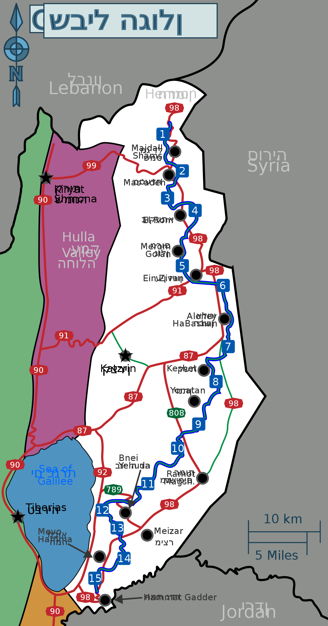
עברית: מפה כללית של הגולן עם כבישים מרכזיים, מספר יישובים ותוואי שביל הגולן, כולל מספרי הקטעים. ישנם כיתובים באנגלית ובעברית החופפים זה לזה. הקובץ נועד כבסיס לקבצי גרפיקה רסטריים. English: Schematic map of the Golan Heights showing main roads, several settlements and the Golan Trail with trail-section numbers. Includes captions in Hebrew and English, overlapping one another. This file is to be used as a base for raster-graphics files. |
| Date | |
| Source | Own work |
| Author | Tamuz |
File:GolanTrailHE.svg was used in the creation of this map.
Raster graphics files will be uploaded to:
Licensing[edit]
I, the copyright holder of this work, hereby publish it under the following license:
| This file is made available under the Creative Commons CC0 1.0 Universal Public Domain Dedication. | |
| The person who associated a work with this deed has dedicated the work to the public domain by waiving all of their rights to the work worldwide under copyright law, including all related and neighboring rights, to the extent allowed by law. You can copy, modify, distribute and perform the work, even for commercial purposes, all without asking permission.
|
File history
Click on a date/time to view the file as it appeared at that time.
| Date/Time | Thumbnail | Dimensions | User | Comment | |
|---|---|---|---|---|---|
| current | 13:40, 22 November 2013 | | 448 × 855 (153 KB) | Tamuz (talk | contribs) | Made the trail-mark more prominent in the map. |
| 23:14, 26 August 2013 |  | 448 × 855 (150 KB) | Tamuz (talk | contribs) | User created page with UploadWizard |
You cannot overwrite this file.
File usage on Commons
There are no pages that use this file.