File:Guadeloupe map EN.svg
Jump to navigation
Jump to search

Size of this PNG preview of this SVG file: 628 × 599 pixels. Other resolutions: 252 × 240 pixels | 503 × 480 pixels | 805 × 768 pixels | 1,073 × 1,024 pixels | 2,146 × 2,048 pixels | 744 × 710 pixels.
Original file (SVG file, nominally 744 × 710 pixels, file size: 98 KB)
Captions
Captions
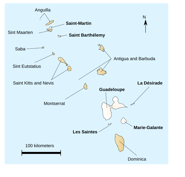
Map of Guadeloupe before 2007, before Saint Martin and Saint Barthelemy broke away from Guadeloupe to become Overseas Territories
Summary[edit]
Dake's map of Guadeloupe and islands in the area, translated into English by Hoshie. Since that map was under CC-BY-SA-2.5, this one is too.
Note: This map does not have the 2007 changes.
Licensing[edit]
This file is licensed under the Creative Commons Attribution-Share Alike 2.5 Generic license.
- You are free:
- to share – to copy, distribute and transmit the work
- to remix – to adapt the work
- Under the following conditions:
- attribution – You must give appropriate credit, provide a link to the license, and indicate if changes were made. You may do so in any reasonable manner, but not in any way that suggests the licensor endorses you or your use.
- share alike – If you remix, transform, or build upon the material, you must distribute your contributions under the same or compatible license as the original.
See Also[edit]
File history
Click on a date/time to view the file as it appeared at that time.
| Date/Time | Thumbnail | Dimensions | User | Comment | |
|---|---|---|---|---|---|
| current | 21:08, 15 August 2007 | | 744 × 710 (98 KB) | Hoshie (talk | contribs) | Dake's map of Guadeloupe and islands in the area, translated into English by ~~~. Since that map was under CC-BY-SA-2.5, this one is too. ''Note: This map does not have the 2007 changes.'' == Licensing == {{cc-by-sa-2.5}} [[Category:SVG ma |
You cannot overwrite this file.
File usage on Commons
There are no pages that use this file.