File:Guayaquil Satelite Blue Marble (retocada).jpg
Jump to navigation
Jump to search
No higher resolution available.
Guayaquil_Satelite_Blue_Marble_(retocada).jpg (306 × 515 pixels, file size: 244 KB, MIME type: image/jpeg)
Captions
Captions
Add a one-line explanation of what this file represents
| Description |
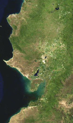
Español: Imagen satelital de la región Litoral del Ecuador. La ciudad de Guayaquil está ubicada en el centro. |
| Date | (UTC) |
| Source | |
| Author |
|
| This is a retouched picture, which means that it has been digitally altered from its original version. The original can be viewed here: Guayaquil Satelite Blue Marble.jpg:
|
| This file is in the public domain in the United States because it was solely created by NASA. NASA copyright policy states that "NASA material is not protected by copyright unless noted". (See Template:PD-USGov, NASA copyright policy page or JPL Image Use Policy.) | ||
 |
Warnings:
|
Original upload log[edit]
.jpg&action=edit§ion=1)
This image is a derivative work of the following images:
- File:Guayaquil_Satelite_Blue_Marble.jpg licensed with PD-USGov-NASA, PD-USGov-NASA/es
- 2009-07-08T01:30:18Z Sageo 306x515 (22696 Bytes) {{Information |Description={{es|1=Imagen satelital de la [[:w:es:Región Litoral del Ecuador|región Litoral]] del Ecuador. La ciudad de Guayaquil está ubicada en el centro.}} |Source=NASA. Blue Marble |Author=NASA |Date=7 d
Uploaded with derivativeFX
File history
Click on a date/time to view the file as it appeared at that time.
| Date/Time | Thumbnail | Dimensions | User | Comment | |
|---|---|---|---|---|---|
| current | 01:34, 8 July 2009 | | 306 × 515 (244 KB) | Sageo (talk | contribs) | {{Information |Description={{es|1=Imagen satelital de la región Litoral del Ecuador. La ciudad de Guayaquil está ubicada en el centro.}} |Source=*File:Guayaquil_Satelite_Blue_Marble.jpg |Date=2009-07-08 01:32 |
You cannot overwrite this file.
File usage on Commons
There are no pages that use this file.
File usage on other wikis
The following other wikis use this file:
- Usage on ast.wikipedia.org
- Usage on es.wikipedia.org
- Usage on mwl.wikipedia.org
.jpg&oldid=497938610)