File:HANGER BEAM AND CUT STONE ABUTMENT LOOKING SOUTHEAST - Kentucky Route 5272 Bridge, Spanning Whippoorwill Creek, Lickskillet, Logan County, KY HAER KY,71-LISKI.V,1-7.tif
Jump to navigation
Jump to search

Size of this JPG preview of this TIF file: 486 × 600 pixels. Other resolutions: 194 × 240 pixels | 389 × 480 pixels | 622 × 768 pixels | 829 × 1,024 pixels | 1,659 × 2,048 pixels | 4,050 × 5,000 pixels.
Original file (4,050 × 5,000 pixels, file size: 19.31 MB, MIME type: image/tiff)
Captions
Captions
Add a one-line explanation of what this file represents
Summary[edit]
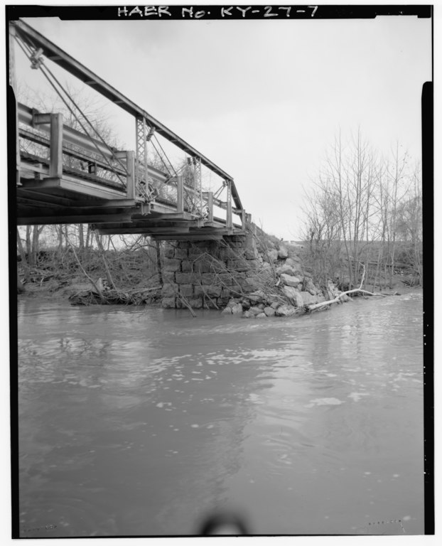
| HANGER BEAM AND CUT STONE ABUTMENT LOOKING SOUTHEAST - Kentucky Route 5272 Bridge, Spanning Whippoorwill Creek, Lickskillet, Logan County, KY | ||||
|---|---|---|---|---|
| Photographer |
Fiegel, J. H. |
|||
| Title |
HANGER BEAM AND CUT STONE ABUTMENT LOOKING SOUTHEAST - Kentucky Route 5272 Bridge, Spanning Whippoorwill Creek, Lickskillet, Logan County, KY |
|||
| Depicted place | Kentucky; Logan County; Lickskillet | |||
| Date | Documentation compiled after 1968; 1989 | |||
| Dimensions | 4 x 5 in. | |||
| Current location |
Library of Congress Prints and Photographs Division Washington, D.C. 20540 USA http://hdl.loc.gov/loc.pnp/pp.print |
|||
| Accession number |
HAER KY,71-LISKI.V,1-7 |
|||
| Credit line |
|
|||
| Notes |
|
|||
| Source | https://www.loc.gov/pictures/item/ky0296.photos.319612p | |||
| Permission (Reusing this file) |
|
|||

| Object location | | View this and other nearby images on: OpenStreetMap |
|---|
File history
Click on a date/time to view the file as it appeared at that time.
| Date/Time | Thumbnail | Dimensions | User | Comment | |
|---|---|---|---|---|---|
| current | 04:18, 20 July 2014 |  | 4,050 × 5,000 (19.31 MB) | Fæ (talk | contribs) | GWToolset: Creating mediafile for Fæ. HABS 16 July 2014 (1201:1400) |
You cannot overwrite this file.
File usage on Commons
The following page uses this file: