File:HISTORIC AERIAL VIEW LOOKING SOUTHWEST AT THE TEST STAND AND THE SURROUNDING ELECTRONICS AND EQUIPMENT TRAILERS. - Marshall Space Flight Center, Redstone Rocket (Missile) Test HAER ALA,45-HUVI.V,7A-45.tif
Jump to navigation
Jump to search

Size of this JPG preview of this TIF file: 749 × 600 pixels. Other resolutions: 300 × 240 pixels | 599 × 480 pixels | 959 × 768 pixels | 1,279 × 1,024 pixels | 2,557 × 2,048 pixels | 5,000 × 4,005 pixels.
Original file (5,000 × 4,005 pixels, file size: 19.1 MB, MIME type: image/tiff)
Captions
Captions
Add a one-line explanation of what this file represents
Summary[edit]
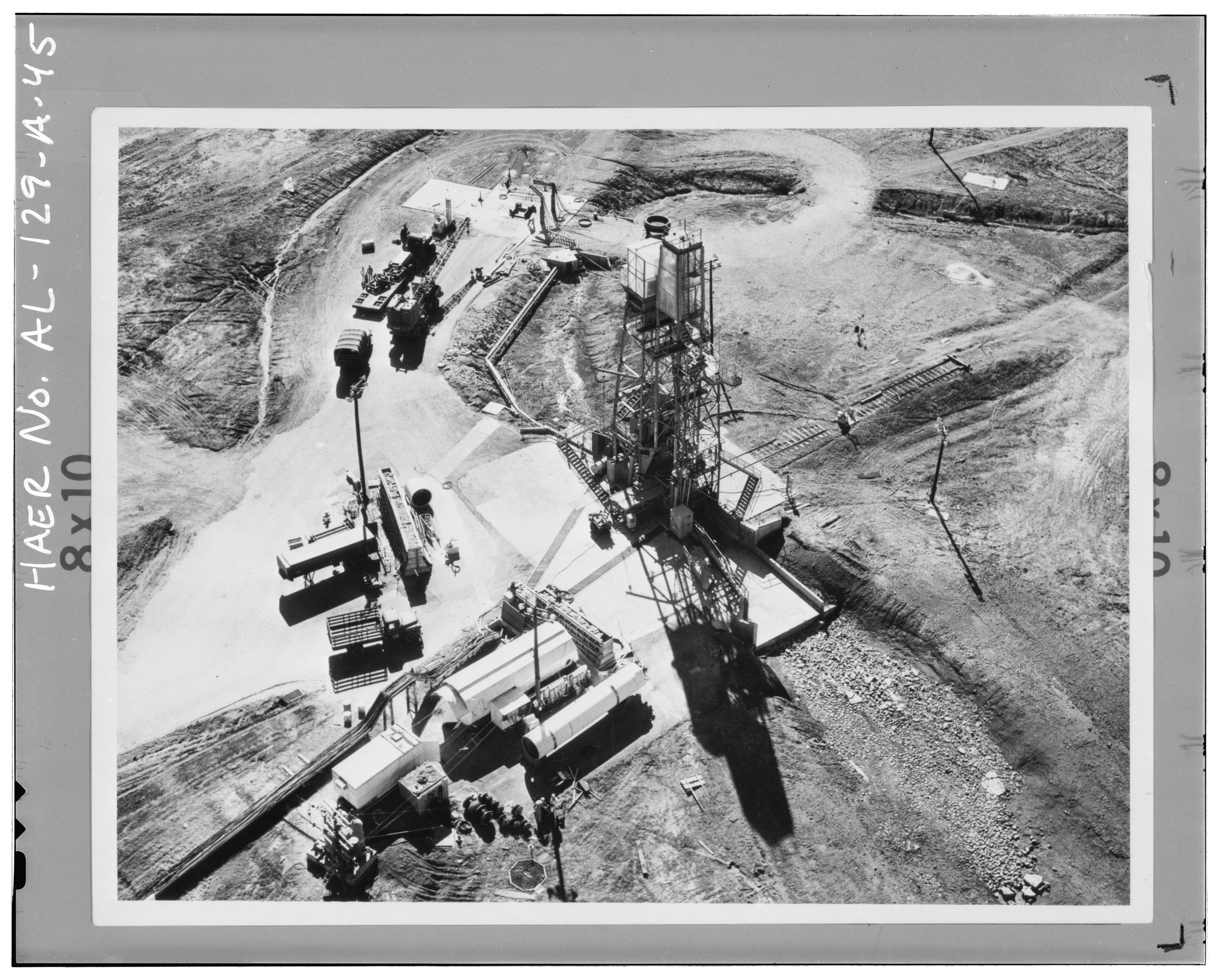
| HISTORIC AERIAL VIEW LOOKING SOUTHWEST AT THE TEST STAND AND THE SURROUNDING ELECTRONICS AND EQUIPMENT TRAILERS. - Marshall Space Flight Center, Redstone Rocket (Missile) Test Stand, Dodd Road, Huntsville, Madison County, AL | ||||
|---|---|---|---|---|
| Title |
HISTORIC AERIAL VIEW LOOKING SOUTHWEST AT THE TEST STAND AND THE SURROUNDING ELECTRONICS AND EQUIPMENT TRAILERS. - Marshall Space Flight Center, Redstone Rocket (Missile) Test Stand, Dodd Road, Huntsville, Madison County, AL |
|||
| Depicted place | Alabama; Madison County; Huntsville | |||
| Dimensions | 4 x 5 in. | |||
| Current location |
Library of Congress Prints and Photographs Division Washington, D.C. 20540 USA http://hdl.loc.gov/loc.pnp/pp.print |
|||
| Accession number |
HAER ALA,45-HUVI.V,7A-45 |
|||
| Credit line |
|
|||
| Source | https://www.loc.gov/pictures/item/al1184.photos.047026p | |||
| Permission (Reusing this file) |
|
|||

| Camera location | | View this and other nearby images on: OpenStreetMap |
|---|
File history
Click on a date/time to view the file as it appeared at that time.
| Date/Time | Thumbnail | Dimensions | User | Comment | |
|---|---|---|---|---|---|
| current | 04:54, 1 July 2014 |  | 5,000 × 4,005 (19.1 MB) | Fæ (talk | contribs) | GWToolset: Creating mediafile for Fæ. HABS batch upload 29 June 2014 (101:150) |
You cannot overwrite this file.
File usage on Commons
The following page uses this file: