File:Hannover Stadtplan 1895 Meyers Konversations-Lexikon 5. Auflage Band 8 Seite 350a3.jpg
Jump to navigation
Jump to search

Size of this preview: 399 × 600 pixels. Other resolutions: 160 × 240 pixels | 319 × 480 pixels | 511 × 768 pixels | 681 × 1,024 pixels | 1,363 × 2,048 pixels | 3,908 × 5,873 pixels.
Original file (3,908 × 5,873 pixels, file size: 14.09 MB, MIME type: image/jpeg)
Captions
Captions
Add a one-line explanation of what this file represents
Summary[edit]
| Description |
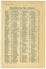
English: Hanover map 1895 approximately, register of street names, first page
Deutsch: Hannover Stadtplan 1895 (Herausgabe des 8. Bandes der 4. Auflage) und davor, "Namen-Register zum "Plan von Hannover".", Strassennamen 1. Seite
Français : Hanovre plan de la ville 1895 à peu près, liste des rues, 1ère page |
| Date | (shown under the title of book 8) and before |
| Source | Book 8 of the 5th edition of Meyers Konversationslexikon (1893-1901), 1895, page 350a3, own scan |
| Author | Meyers Konversations-Lexikon |
52° 22′ N, 9° 44′ O
Licensing[edit]
| This image comes from the 5th edition of Meyers Konversationslexikon (1893-97). The copyrights have expired and this image is in the public domain. | 
|
This work was published before January 1, 1899 and it is anonymous or pseudonymous due to unknown authorship. It is in the public domain in the United States as well as countries and areas where the copyright terms of anonymous or pseudonymous works are 125 years or fewer since publication.
|
File history
Click on a date/time to view the file as it appeared at that time.
| Date/Time | Thumbnail | Dimensions | User | Comment | |
|---|---|---|---|---|---|
| current | 11:17, 26 March 2010 | | 3,908 × 5,873 (14.09 MB) | Bernd Schwabe in Hannover (talk | contribs) | {{Information |Description={{en|1=Hanover map 1895 approximately, register of street names, first page}} {{de|1=Hannover Stadtplan 1895 (Herausgabe des 8. Bandes der 4. Auflage) und davor, "Namen-Register zum "Plan von Hannover".", Strassennamen 1. Seite} |
You cannot overwrite this file.
File usage on Commons
There are no pages that use this file.