File:Hogan-Borger Mound Archeological District.jpg
Jump to navigation
Jump to search

Size of this preview: 800 × 450 pixels. Other resolutions: 320 × 180 pixels | 640 × 360 pixels | 1,024 × 576 pixels | 1,280 × 720 pixels | 2,816 × 1,584 pixels.
Original file (2,816 × 1,584 pixels, file size: 1.05 MB, MIME type: image/jpeg)
Captions
Captions
Add a one-line explanation of what this file represents
|
This is an image of a place or building that is listed on the National Register of Historic Places in the United States of America. Its reference number is 75001338. |
| Camera location | | View this and other nearby images on: OpenStreetMap |
|---|
| Description |
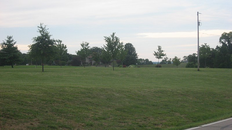
English: Land along the eastern side of Hamilton-New London Road north of Ross in Ross Township, Butler County, Ohio, United States. Much of this land is part of the Hogan-Borger Mound Archeological District, an archaeological site and historic district at the site of several large (but now destroyed) Indian mounds. The district is listed on the National Register of Historic Places. |
||
| Date | Taken on 5 August 2013 | ||
| Source | Own work | ||
| Author | Nyttend | ||
| Permission (Reusing this file) |
|
File history
Click on a date/time to view the file as it appeared at that time.
| Date/Time | Thumbnail | Dimensions | User | Comment | |
|---|---|---|---|---|---|
| current | 21:08, 1 September 2013 | | 2,816 × 1,584 (1.05 MB) | Nyttend (talk | contribs) | {{NRHP|75001338}} {{Location|39|20|47|N|84|39|38|W}} {{Information |Description={{en|Land along the eastern side of Hamilton-New London Road north of {{w|Ross, Ohio|Ross}} in {{w|Ross Township, Butler County, Ohio|Ross Township}}, {{w|Butler County, Oh... |
You cannot overwrite this file.
File usage on Commons
There are no pages that use this file.
File usage on other wikis
The following other wikis use this file:
- Usage on en.wikipedia.org
- Usage on www.wikidata.org