File:Jeanne 2004-09-25 1615Z (cropped).jpg

Original file (5,200 × 5,200 pixels, file size: 5.47 MB, MIME type: image/jpeg)
Captions
Captions
Summary[edit]
| Description |
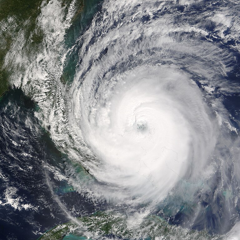
The eye of Hurricane Jeanne was centered over the narrow gap of water between Abaco Island, right, and Grand Bahama Island, left, on September 25, 2004, when the Moderate Resolution Imaging Spectroradiometer (MODIS) on NASA’s Terra satellite acquired this image. As the eye of the storm passed directly over Abaco Island and skirted the north coast of Grand Bahama Island, it strengthened from a Category 2 storm to a dangerous Category 3 hurricane. Between 8 a.m. and 11 a.m. EDT, sustained wind speeds went from 165 kilometers per hour (105 mph) to 185 kph (115 mph), according to the National Hurricane Center. This image was acquired at 10:15 a.m. EDT, during the strengthening period. When Jeanne reached Category 3 status, it became the sixth major hurricane of the 2004 Atlantic season. This image is available in additional resolutions from the MODIS Rapid Response Team. |
|||||
| Date | ||||||
| Source | http://visibleearth.nasa.gov/view_rec.php?id=6654 | |||||
| Author | Jacques Descloitres, MODIS Rapid Response Team, NASA/GSFC | |||||
| Permission (Reusing this file) |
|
|||||
| Other versions | Image:Hurricane Jeanne 25 sept 1615Z full.jpg |

.jpg&action=edit§ion=1)
File history
Click on a date/time to view the file as it appeared at that time.
| Date/Time | Thumbnail | Dimensions | User | Comment | |
|---|---|---|---|---|---|
| current | 22:28, 17 August 2006 | | 5,200 × 5,200 (5.47 MB) | Good kitty (talk | contribs) | == Summary == {{Information |Description=The eye of Hurricane Jeanne was centered over the narrow gap of water between Abaco Island, right, and Grand Bahama Island, left, on September 25, 2004, when the Moderate Resolution Imaging Spectroradiometer (MODIS |
You cannot overwrite this file.
File usage on Commons
The following page uses this file:
- File:Hurricane jeanne 2004.jpg (file redirect)
File usage on other wikis
The following other wikis use this file:
- Usage on de.wikipedia.org
- Usage on en.wikipedia.org
- Usage on fr.wikipedia.org
- Usage on pl.wikipedia.org
- Usage on pt.wikipedia.org
- Usage on simple.wikipedia.org
.jpg&oldid=791378673)