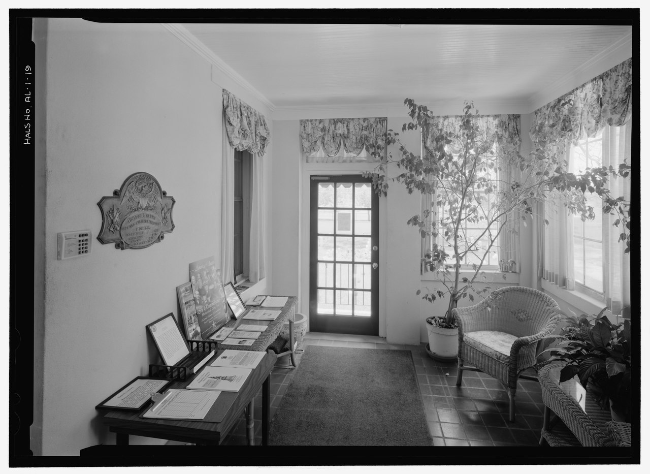
File:INTERIOR VIEW OF LODGE BUILDING, FIRST FLOOR ENCLOSED ENTRY PORCH, WITH MOBILE NATIONAL CEMETERY PLAQUE AT LEFT. VIEW TO SOUTH. - Mobile National Cemetery, 1202 Virginia Street, Mobile, HALS AL-1-19.tif
Jump to navigation
Jump to search

Size of this JPG preview of this TIF file: 800 × 583 pixels. Other resolutions: 320 × 233 pixels | 640 × 467 pixels | 1,024 × 747 pixels | 1,280 × 933 pixels | 2,560 × 1,867 pixels | 5,088 × 3,710 pixels.
Original file (5,088 × 3,710 pixels, file size: 18 MB, MIME type: image/tiff)
Captions
Captions
Add a one-line explanation of what this file represents
Summary[edit]
| INTERIOR VIEW OF LODGE BUILDING, FIRST FLOOR ENCLOSED ENTRY PORCH, WITH MOBILE NATIONAL CEMETERY PLAQUE AT LEFT. VIEW TO SOUTH. - Mobile National Cemetery, 1202 Virginia Street, Mobile, Mobile County, AL | ||||
|---|---|---|---|---|
| Photographer |
Fraser, Clayton B. Fraserdesign., creator |
|||
| Title |
INTERIOR VIEW OF LODGE BUILDING, FIRST FLOOR ENCLOSED ENTRY PORCH, WITH MOBILE NATIONAL CEMETERY PLAQUE AT LEFT. VIEW TO SOUTH. - Mobile National Cemetery, 1202 Virginia Street, Mobile, Mobile County, AL |
|||
| Depicted place | Alabama; Mobile County; Mobile | |||
| Date | 2006 | |||
| Dimensions | 5 x 7 in. | |||
| Current location |
Library of Congress Prints and Photographs Division Washington, D.C. 20540 USA http://hdl.loc.gov/loc.pnp/pp.print |
|||
| Accession number |
HALS AL-1-19 |
|||
| Credit line |
|
|||
| Source | https://www.loc.gov/pictures/item/al1321.photos.364458p | |||
| Permission (Reusing this file) |
|
|||

| Camera location | | View this and other nearby images on: OpenStreetMap |
|---|
File history
Click on a date/time to view the file as it appeared at that time.
| Date/Time | Thumbnail | Dimensions | User | Comment | |
|---|---|---|---|---|---|
| current | 22:16, 26 June 2014 |  | 5,088 × 3,710 (18 MB) | Fæ (talk | contribs) | GWToolset: Creating mediafile for Fæ. HABS batch upload 26 June 2014 (151:200) |
You cannot overwrite this file.
File usage on Commons
The following page uses this file: