File:Karte Freiburg i.B. - Stadttunnel.png
Jump to navigation
Jump to search

Size of this preview: 800 × 412 pixels. Other resolutions: 320 × 165 pixels | 640 × 330 pixels | 1,024 × 528 pixels | 1,280 × 659 pixels | 2,013 × 1,037 pixels.
Original file (2,013 × 1,037 pixels, file size: 3.24 MB, MIME type: image/png)
Captions
Captions
Add a one-line explanation of what this file represents
Summary[edit]
| Description |
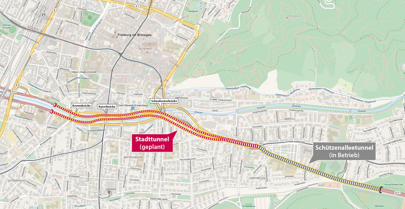
Deutsch: Karte des geplanten Stadttunnels in Freiburg i.B.
English: Map of the planned city tunnel in Freiburg i.B. |
|||
| Date | see file history | |||
| Source | Own work, using OpenStreetMap data | |||
| Author | Maximilian Dörrbecker (Chumwa) | |||
| Permission (Reusing this file) |
This file is licensed under the Creative Commons Attribution-Share Alike 2.0 Generic license.
Sie dürfen das Bild zu den folgenden Bedingungen nutzen:
|
File history
Click on a date/time to view the file as it appeared at that time.
| Date/Time | Thumbnail | Dimensions | User | Comment | |
|---|---|---|---|---|---|
| current | 15:24, 12 July 2014 | | 2,013 × 1,037 (3.24 MB) | Chumwa (talk | contribs) | == {{int:filedesc}} == {{Information |Description = {{de|1=Karte des geplanten Stadttunnels in Freiburg i.B.}} {{en|1=Map of the planned city tunnel in Freiburg i.B.}} |Source={{own}}, using OpenStreetMap data |Date = see file history |... |
You cannot overwrite this file.
File usage on Commons
The following 2 pages use this file:
File usage on other wikis
The following other wikis use this file:
- Usage on de.wikipedia.org