File:Karte Hemer-Deilinghofen.png
Jump to navigation
Jump to search

Size of this preview: 554 × 599 pixels. Other resolutions: 222 × 240 pixels | 444 × 480 pixels | 673 × 728 pixels.
Original file (673 × 728 pixels, file size: 22 KB, MIME type: image/png)
Captions
Captions
Add a one-line explanation of what this file represents
| Description | |
| Date | |
| Source | Own work |
| Author | NordNordWest |
| Permission (Reusing this file) |
This file is licensed under the Creative Commons Attribution-Share Alike 3.0 Unported license.
|

|
This map has been made or improved in the German Kartenwerkstatt (Map Lab). You can propose maps to improve as well.
|
File history
Click on a date/time to view the file as it appeared at that time.
| Date/Time | Thumbnail | Dimensions | User | Comment | |
|---|---|---|---|---|---|
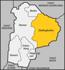
| current | 17:34, 28 July 2009 | | 673 × 728 (22 KB) | NordNordWest (talk | contribs) | {{Information |Description= {{de|Karte der ehemaligen Gemeinde Deilinghofen in der heutigen Stadt Hemer im Märkischen Kreis}} {{en|Map of former municipality Deilinghofen in [[:en:Hemer|Hemer] |
You cannot overwrite this file.
File usage on Commons
The following 3 pages use this file:
File usage on other wikis
The following other wikis use this file:
- Usage on de.wikipedia.org
- Usage on www.wikidata.org