File:Karte Verwaltungsgliederung Äthiopien 1987-1991.png
Jump to navigation
Jump to search
Size of this preview: 570 × 600 pixels. Other resolutions: 228 × 240 pixels | 456 × 480 pixels | 730 × 768 pixels | 1,266 × 1,332 pixels.
Original file (1,266 × 1,332 pixels, file size: 203 KB, MIME type: image/png)
Captions
Captions
Add a one-line explanation of what this file represents
Summary[edit]
| Description |
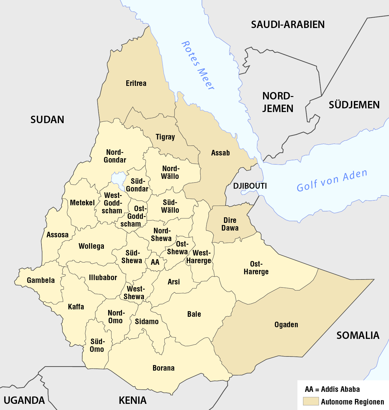
Deutsch: Karte der Verwaltungsgliederung Äthiopiens 1987-1991
English: Map of the 30 regions of Ethiopia, 1987-1991 |
| Date | see file history |
| Source |
Own work, using the information from |
| Author | Maximilian Dörrbecker (Chumwa) |
| Permission (Reusing this file) |
I, the copyright holder of this work, hereby publish it under the following license: This file is licensed under the Creative Commons Attribution-Share Alike 2.5 Generic license.
Sie dürfen das Bild zu den folgenden Bedingungen nutzen:
|
File history
Click on a date/time to view the file as it appeared at that time.
| Date/Time | Thumbnail | Dimensions | User | Comment | |
|---|---|---|---|---|---|
| current | 06:53, 23 October 2016 | | 1,266 × 1,332 (203 KB) | Chumwa (talk | contribs) | corr |
| 11:37, 17 November 2013 |  | 1,266 × 1,332 (203 KB) | Chumwa (talk | contribs) | == {{int:filedesc}} == {{Information |Description = {{de|1=Karte der Verwaltungsgliederung Äthiopiens 1987-1991}} |Source = {{own}}, using the information from Negussay Ayele: [ http://www.ethiopians.com/Negussay_NaturalSeaShores.htm On Ethi... |
You cannot overwrite this file.
File usage on Commons
The following 2 pages use this file:
File usage on other wikis
The following other wikis use this file:
- Usage on de.wikipedia.org
- Usage on fr.wikipedia.org
- Usage on sv.wikipedia.org
- Usage on uk.wikipedia.org
- Usage on zh.wikipedia.org