File:Lacs Tunis, Bizerte, Ichkeul.jpg
Jump to navigation
Jump to search
Size of this preview: 800 × 336 pixels. Other resolutions: 320 × 134 pixels | 976 × 410 pixels.
Original file (976 × 410 pixels, file size: 89 KB, MIME type: image/jpeg)
Captions
Captions
Add a one-line explanation of what this file represents
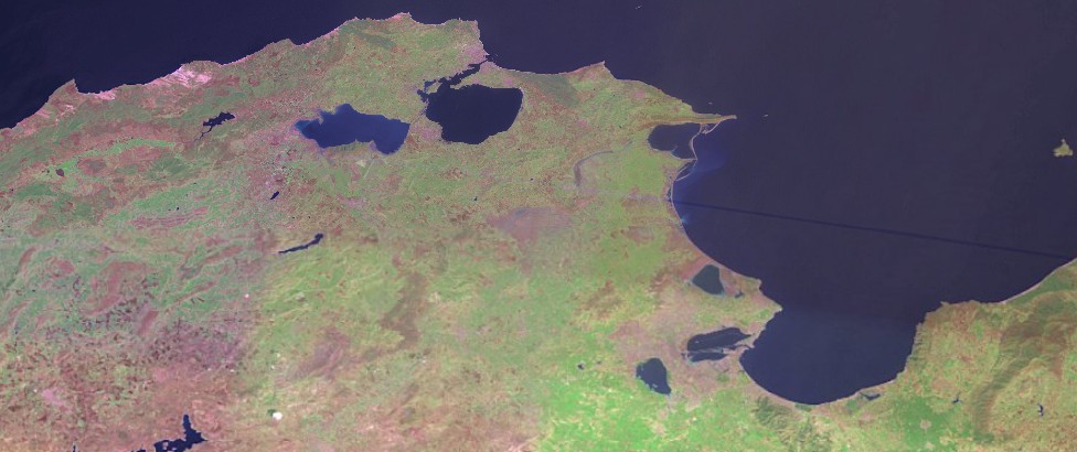
| Description | Satellite image of Northern Tunisia (Lakes Tunis, Bizerte, Ichkeul, Ghar El Melh...). | |||
| Date | ||||
| Source | Taken from NASA World Wind, OnEarth WMS global mosaic visual colour layer. | |||
| Author | NASA | |||
| Permission (Reusing this file) |
|

File history
Click on a date/time to view the file as it appeared at that time.
| Date/Time | Thumbnail | Dimensions | User | Comment | |
|---|---|---|---|---|---|
| current | 10:00, 18 May 2008 | | 976 × 410 (89 KB) | DrFO.Jr.Tn (talk | contribs) | {{Information |Description= Satellite image of Northern Tunisia (Lakes Tunis, Bizerte, Ichkeul, Ghar El Melh...). |Source= Taken from NASA World Wind, OnEarth WMS global mosaic visual colour layer. |Date= 18 May 2008 |Author= NASA |Permission= {{PD-WorldW |
You cannot overwrite this file.
File usage on Commons
There are no pages that use this file.
File usage on other wikis
The following other wikis use this file:
- Usage on ar.wikipedia.org
- Usage on az.wikipedia.org
- Usage on be.wikipedia.org
- Usage on lt.wikipedia.org
- Usage on lv.wikipedia.org
- Usage on ru.wikipedia.org