File:Little Andaman STS032-72-64.jpg
Jump to navigation
Jump to search
Size of this preview: 597 × 600 pixels. Other resolutions: 239 × 240 pixels | 478 × 480 pixels | 765 × 768 pixels | 1,019 × 1,024 pixels | 2,039 × 2,048 pixels | 5,246 × 5,270 pixels.
Original file (5,246 × 5,270 pixels, file size: 6.89 MB, MIME type: image/jpeg)
Captions
Captions
Add a one-line explanation of what this file represents
Summary[edit]
| Description |
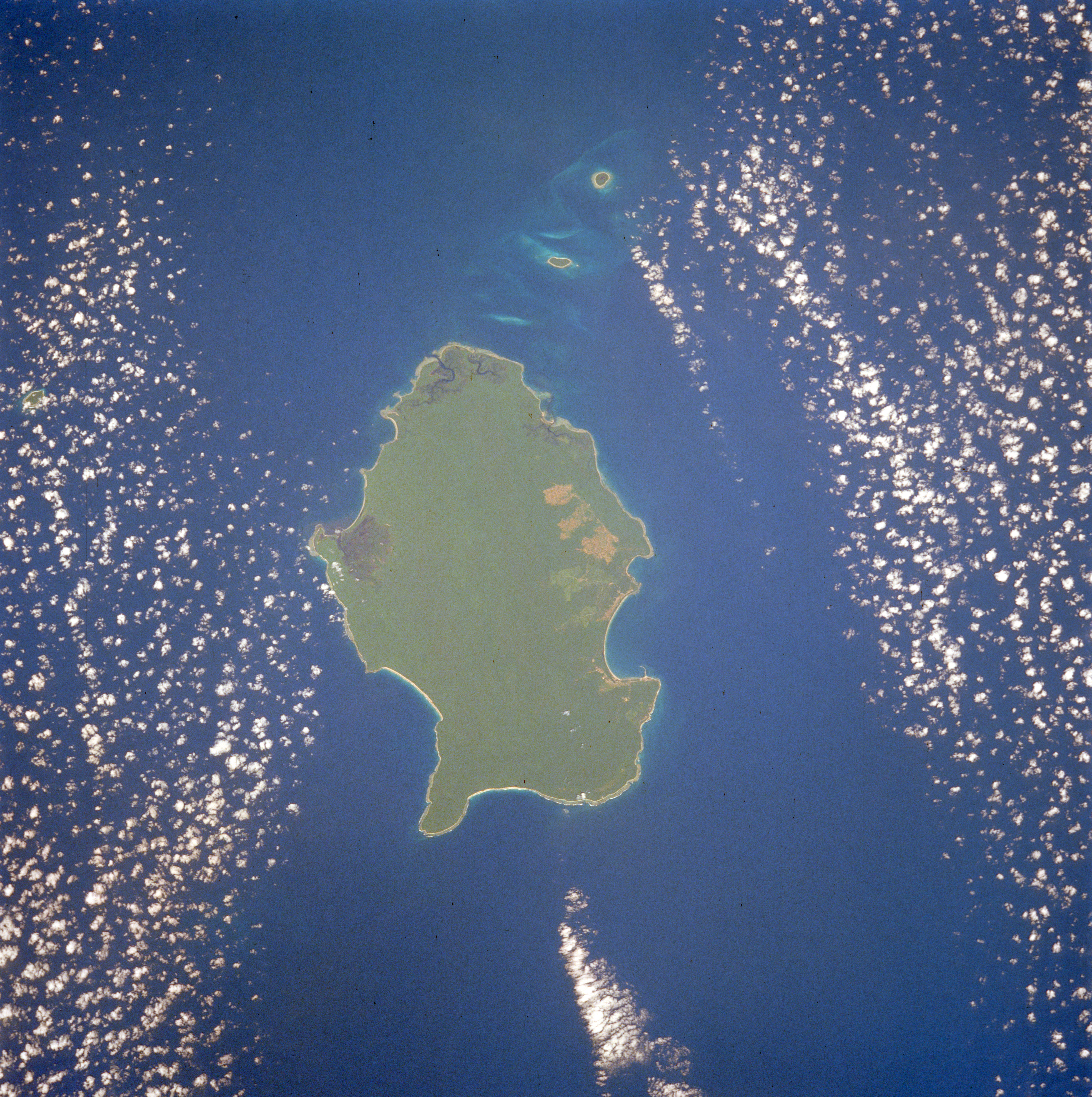
English: Little Andaman Island, Andaman Islands. Photo taken from 1990 Space Shuttle mission (STS032). Img rotated. Shows island in-between banks of high clouds, with Duncan Passage and the islets of "the Brothers" above. |
| Date | |
| Source | http://eol.jsc.nasa.gov/scripts/sseop/photo.pl?mission=STS032&roll=72&frame=64 |
| Author | NASA/Crew of STS-32 |
| Permission (Reusing this file) |
Image Science and Analysis Laboratory, NASA-Johnson Space Center. 25 Mar. 2005. "Astronaut Photography of Earth - Display Record." <> (18 Sep. 2005). |
| Camera location | | View this and other nearby images on: OpenStreetMap |
|---|
This image or video was catalogued by Johnson Space Center of the United States National Aeronautics and Space Administration (NASA) under Photo ID: STS032-72-64. This tag does not indicate the copyright status of the attached work. A normal copyright tag is still required. See Commons:Licensing. Other languages:
|
Licensing[edit]
This file is in the public domain in the United States because it was created by the Image Science & Analysis Laboratory, of the NASA Johnson Space Center. NASA copyright policy states that "NASA material is not protected by copyright unless noted". (NASA media use guidelines or Conditions of Use of Astronaut Photographs).
Photo source: STS032-72-64.
|
File history
Click on a date/time to view the file as it appeared at that time.
| Date/Time | Thumbnail | Dimensions | User | Comment | |
|---|---|---|---|---|---|
| current | 13:45, 20 December 2014 | | 5,246 × 5,270 (6.89 MB) | Ras67 (talk | contribs) | high resolution |
| 20:29, 16 December 2014 |  | 445 × 451 (147 KB) | Ras67 (talk | contribs) | losslessly cropped with Jpegcrop | |
| 11:48, 18 September 2005 |  | 480 × 640 (170 KB) | CJLL Wright (talk | contribs) | '''Little Andaman Island''', Andaman Islands. Photo taken from 1990 Space Shuttle mission (STS032). Img rotated, direction and scale indicators added. Shows island in-between banks of high clouds, with Duncan Passage and the islets of "the Brothers" above |
You cannot overwrite this file.
File usage on Commons
The following page uses this file:
File usage on other wikis
The following other wikis use this file:
- Usage on az.wikipedia.org
- Usage on be.wikipedia.org
- Usage on de.wikipedia.org
- Usage on en.wikipedia.org
- Usage on es.wikipedia.org
- Usage on fr.wikipedia.org
- Usage on hi.wikipedia.org
- Usage on id.wikipedia.org
- Usage on it.wikipedia.org
- Usage on mk.wikipedia.org
- Usage on nl.wikipedia.org
- Usage on pl.wikipedia.org
- Usage on pt.wikipedia.org
- Usage on ru.wikipedia.org
- Usage on ta.wikipedia.org
- Usage on vi.wikipedia.org