File:METX 204 at 16th Street Tower (4561884211).jpg
Jump to navigation
Jump to search

Size of this preview: 800 × 466 pixels. Other resolutions: 320 × 186 pixels | 640 × 372 pixels | 1,024 × 596 pixels | 1,280 × 745 pixels | 2,696 × 1,569 pixels.
Original file (2,696 × 1,569 pixels, file size: 542 KB, MIME type: image/jpeg)
Captions
Captions
Add a one-line explanation of what this file represents
Summary[edit]
.jpg&action=edit§ion=1)
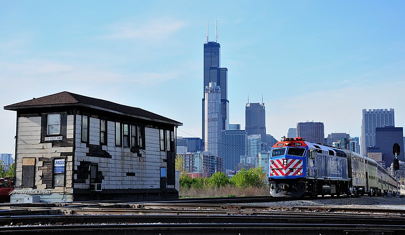
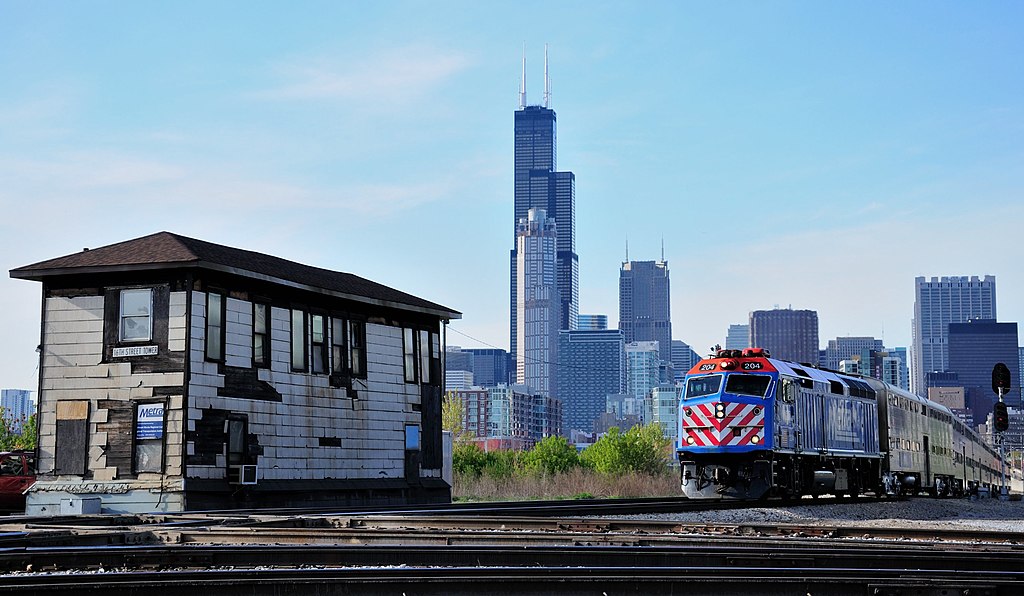
| Description | Metra (METX) 204 leads a rush hour train of bi-levels towards the 16th street crossing over the St. Charles Air Line. 16th Street tower handles traffic through the crossing. |
| Date | |
| Source |
|
| Author | vxla from Chicago, US |
| Camera location | | View this and other nearby images on: OpenStreetMap |
|---|
.jpg¶ms=041.860831_N_-087.630772_E_globe:Earth_type:camera_source:Flickr_&language=en)
Licensing[edit]
.jpg&action=edit§ion=2)
This file is licensed under the Creative Commons Attribution 2.0 Generic license.
- You are free:
- to share – to copy, distribute and transmit the work
- to remix – to adapt the work
- Under the following conditions:
- attribution – You must give appropriate credit, provide a link to the license, and indicate if changes were made. You may do so in any reasonable manner, but not in any way that suggests the licensor endorses you or your use.
| This image, originally posted to Flickr, was reviewed on 1 February 2014 by the administrator or reviewer File Upload Bot (Magnus Manske), who confirmed that it was available on Flickr under the stated license on that date. |
File history
Click on a date/time to view the file as it appeared at that time.
| Date/Time | Thumbnail | Dimensions | User | Comment | |
|---|---|---|---|---|---|
| current | 23:05, 1 February 2014 | | 2,696 × 1,569 (542 KB) | File Upload Bot (Magnus Manske) (talk | contribs) | Transferred from Flickr by User:Mackensen |
You cannot overwrite this file.
File usage on Commons
The following page uses this file:
.jpg&oldid=755663986)