File:Madeline 1976 rainfall.gif
Jump to navigation
Jump to search

Size of this preview: 590 × 599 pixels. Other resolutions: 236 × 240 pixels | 472 × 480 pixels | 870 × 884 pixels.
Original file (870 × 884 pixels, file size: 31 KB, MIME type: image/gif)
Captions
Captions
Add a one-line explanation of what this file represents
Summary
| Description |
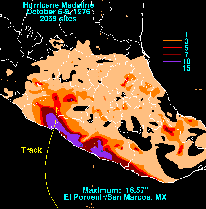
English: Storm total rainfall map of Hurricane Madeline during October 1976. |
|||
| Date | ||||
| Source | WPC tropical cyclone rainfall data | |||
| Author | David Roth, Weather Prediction Center, Camp Springs, Maryland | |||
| Permission (Reusing this file) |
|
File history
Click on a date/time to view the file as it appeared at that time.
| Date/Time | Thumbnail | Dimensions | User | Comment | |
|---|---|---|---|---|---|
| current | 17:37, 3 April 2010 | | 870 × 884 (31 KB) | Cyclonebiskit (talk | contribs) | {{Information |Description={{en|1=A tropical disturbance formed 300 miles south of the coast of Guatemala, quickly gaining tropical storm strength on September 28th. The system weakened thereafter, becoming ill-defined on the 30th. It remnant tropical d |
You cannot overwrite this file.
File usage on Commons
The following page uses this file:
- File:Madeline1976filledrainblk.gif (file redirect)
File usage on other wikis
The following other wikis use this file:
- Usage on en.wikipedia.org
- Usage on zh.wikipedia.org