File:Mamou Region Guinea locator.png
Jump to navigation
Jump to search
No higher resolution available.
Mamou_Region_Guinea_locator.png (386 × 314 pixels, file size: 5 KB, MIME type: image/png)
Captions
Captions
Add a one-line explanation of what this file represents

|
This locator map image could be re-created using vector graphics as an SVG file. This has several advantages; see Commons:Media for cleanup for more information. If an SVG form of this image is available, please upload it and afterwards replace this template with
{{vector version available|new image name}}.
It is recommended to name the SVG file “Mamou Region Guinea locator.svg”—then the template Vector version available (or Vva) does not need the new image name parameter. |
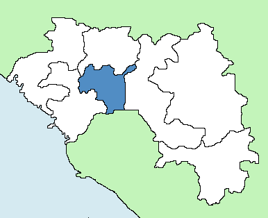
| Description | Map showing location of Mamou Region in Guinea |
| Date | |
| Source | Own work |
| Author | Mr Accountable |
| Permission (Reusing this file) |
GFDL |
en:Map showing location of Mamou Region in Guinea
Drawn by/dessiné par Mr Accountable

|
Permission is granted to copy, distribute and/or modify this document under the terms of the GNU Free Documentation License, Version 1.2 or any later version published by the Free Software Foundation; with no Invariant Sections, no Front-Cover Texts, and no Back-Cover Texts. A copy of the license is included in the section entitled GNU Free Documentation License. |
| This file is licensed under the Creative Commons Attribution-Share Alike 3.0 Unported license. | ||
| ||
| This licensing tag was added to this file as part of the GFDL licensing update. |
File history
Click on a date/time to view the file as it appeared at that time.
| Date/Time | Thumbnail | Dimensions | User | Comment | |
|---|---|---|---|---|---|
| current | 16:42, 13 December 2007 | | 386 × 314 (5 KB) | Mr Accountable (talk | contribs) | {{Information |Description= Map showing location of Mamou Region in Guinea |Source=self-made |Date=Dec 13 2007 |Author= Mr Accountable |Permission=GFDL |other_versions= }} en:Map showing location of Mamou Region in Guinea Drawn b |
You cannot overwrite this file.
File usage on Commons
There are no pages that use this file.