File:Map-Prussia-PWP.png
Jump to navigation
Jump to search

Size of this preview: 706 × 599 pixels. Other resolutions: 283 × 240 pixels | 565 × 480 pixels | 905 × 768 pixels | 1,206 × 1,024 pixels | 1,750 × 1,486 pixels.
Original file (1,750 × 1,486 pixels, file size: 140 KB, MIME type: image/png)
Captions
Captions
Add a one-line explanation of what this file represents

|
File:Map-Prussia-PWP.svg is a vector version of this file. It should be used in place of this PNG file.
File:Map-Prussia-PWP.png → File:Map-Prussia-PWP.svg
For more information, see Help:SVG. |
 |

|
This map has been uploaded by Electionworld from en.wikipedia.org to enable the |
Summary[edit]
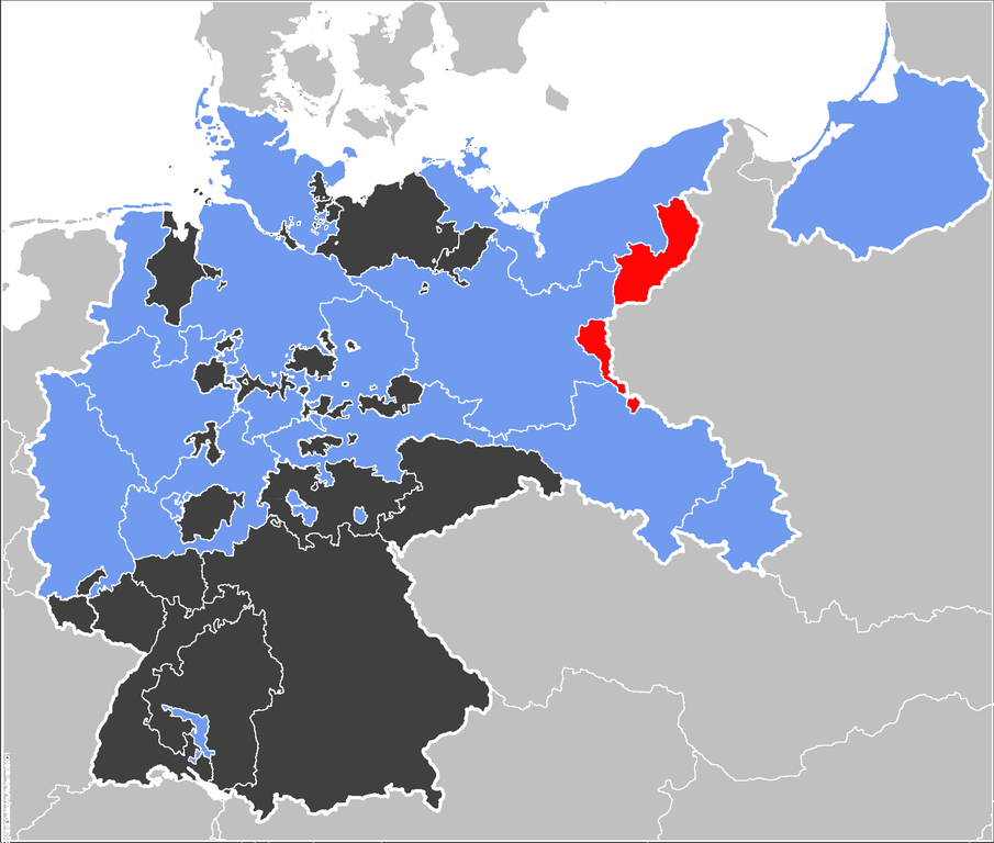
The Prussian Province of Posen-West Prussia (red}, within the Free State of Prussia (blue). Other members of the German Confederation shown in black.
Source[edit]
Map data of the IEG-Maps project by Andreas Kunz, B. Johnen and Joachim Robert Moeschl of the University of Mainz. For further info visit: http://www.ieg-maps.uni-mainz.de
Licensing[edit]
| This work has been released into the public domain by its author, 52 Pickup. This applies worldwide. In some countries this may not be legally possible; if so: |
File history
Click on a date/time to view the file as it appeared at that time.
| Date/Time | Thumbnail | Dimensions | User | Comment | |
|---|---|---|---|---|---|
| current | 22:21, 29 December 2006 | | 1,750 × 1,486 (140 KB) | Electionworld (talk | contribs) | {{ew|en|52 Pickup}} == Summary == The Prussian {{link|Province of Posen-West Prussia}} (red}, within the {{link|Kingdom of Prussia}} (blue). Other members of the {{link|German Confederation}} shown in black. ==Source== Map data of the IEG-Maps project by |
You cannot overwrite this file.
File usage on Commons
There are no pages that use this file.