File:Map of Michigan highlighting Muskegon County.svg
Jump to navigation
Jump to search

Size of this PNG preview of this SVG file: 512 × 599 pixels. Other resolutions: 205 × 240 pixels | 410 × 480 pixels | 656 × 768 pixels | 874 × 1,024 pixels | 1,749 × 2,048 pixels | 6,256 × 7,325 pixels.
Original file (SVG file, nominally 6,256 × 7,325 pixels, file size: 205 KB)
Captions
Captions
Add a one-line explanation of what this file represents
Summary[edit]
| Description |
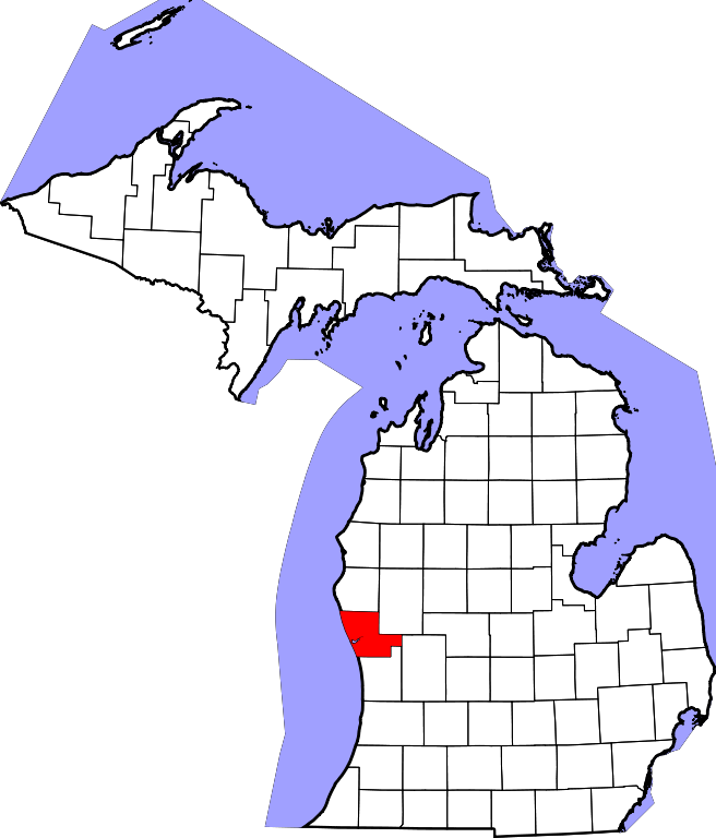
English: This is a locator map showing Muskegon County in Michigan. For more information, see Commons:United States county locator maps. |
| Date | |
| Source |
Own work: English: The maps use data from nationalatlas.gov, specifically countyp020.tar.gz on the Raw Data Download page. The maps also use state outline data from statesp020.tar.gz. The Florida maps use hydrogm020.tar.gz to display Lake Okeechobee. |
| Author | David Benbennick |
Licensing[edit]
| I, the copyright holder of this work, release this work into the public domain. This applies worldwide. In some countries this may not be legally possible; if so: I grant anyone the right to use this work for any purpose, without any conditions, unless such conditions are required by law. |
| Annotations | This image is annotated: View the annotations at Commons |
File history
Click on a date/time to view the file as it appeared at that time.
| Date/Time | Thumbnail | Dimensions | User | Comment | |
|---|---|---|---|---|---|
| current | 12:58, 12 February 2006 | | 6,256 × 7,325 (205 KB) | David Benbennick (talk | contribs) | {{subst:User:Dbenbenn/clm|county=Muskegon County|state=Michigan|type=county}} |
You cannot overwrite this file.
File usage on Commons
The following 7 pages use this file:
- Category:Births in Muskegon County, Michigan
- Category:Deaths in Muskegon County, Michigan
- Category:Geography of Muskegon County, Michigan
- Category:Maps of Muskegon County, Michigan
- Category:Muskegon County, Michigan
- Category:Muskegon County, Michigan Image by CLight
- Category:People of Muskegon County, Michigan
File usage on other wikis
The following other wikis use this file:
- Usage on ar.wikipedia.org
- Usage on bg.wikipedia.org
- Usage on bpy.wikipedia.org
- Usage on cdo.wikipedia.org
- Usage on ceb.wikipedia.org
- Usage on cy.wikipedia.org
- Usage on de.wikipedia.org
- Usage on en.wikipedia.org
- List of counties in Michigan
- Muskegon County, Michigan
- Casnovia Township, Michigan
- Dalton Township, Michigan
- Egelston Township, Michigan
- Fruitland Township, Michigan
- Fruitport, Michigan
- Fruitport Charter Township, Michigan
- Holton Township, Michigan
- Laketon Township, Michigan
- Lakewood Club, Michigan
- Montague, Michigan
- Montague Township, Michigan
- Moorland Township, Michigan
- Muskegon, Michigan
- Muskegon Township, Michigan
- Muskegon Heights, Michigan
- North Muskegon, Michigan
- Norton Shores, Michigan
- Ravenna, Michigan
- Ravenna Township, Michigan
- Roosevelt Park, Michigan
- Sullivan Township, Michigan
- Twin Lake, Michigan
- White River Township, Michigan
- Whitehall, Michigan
- Whitehall Township, Michigan
- Wolf Lake, Michigan
- Casnovia, Michigan
- Wabaningo, Michigan
- White River (White Lake)
- Pere Marquette Beach
- Template:Muskegon County, Michigan
- User:Nyttend/County templates/MI/2
- Blue Lake Township, Muskegon County, Michigan
- Cedar Creek Township, Muskegon County, Michigan
View more global usage of this file.