File:Map of Minnesota highlighting Otter Tail County.svg
Jump to navigation
Jump to search

Size of this PNG preview of this SVG file: 527 × 600 pixels. Other resolutions: 211 × 240 pixels | 422 × 480 pixels | 675 × 768 pixels | 900 × 1,024 pixels | 1,800 × 2,048 pixels | 5,746 × 6,539 pixels.
Original file (SVG file, nominally 5,746 × 6,539 pixels, file size: 104 KB)
Captions
Captions
Add a one-line explanation of what this file represents
Summary[edit]
| Description |
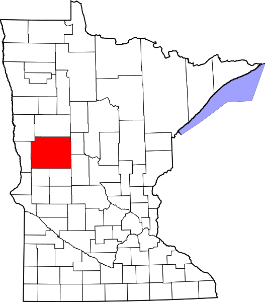
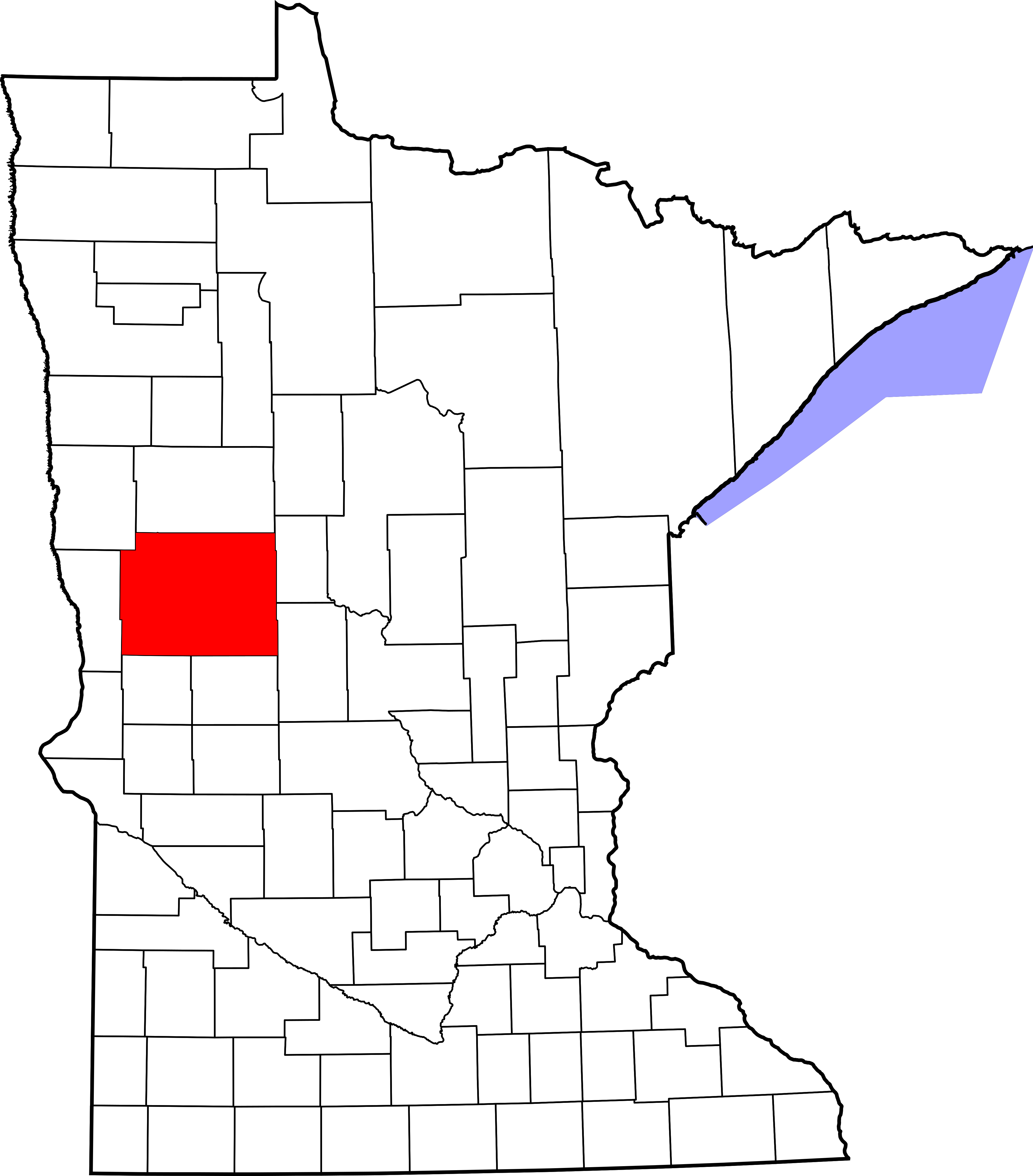
English: This is a locator map showing Otter Tail County in Minnesota. For more information, see Commons:United States county locator maps. |
| Date | |
| Source |
Own work: English: The maps use data from nationalatlas.gov, specifically countyp020.tar.gz on the Raw Data Download page. The maps also use state outline data from statesp020.tar.gz. The Florida maps use hydrogm020.tar.gz to display Lake Okeechobee. |
| Author | David Benbennick |
Licensing[edit]
| I, the copyright holder of this work, release this work into the public domain. This applies worldwide. In some countries this may not be legally possible; if so: I grant anyone the right to use this work for any purpose, without any conditions, unless such conditions are required by law. |
File history
Click on a date/time to view the file as it appeared at that time.
| Date/Time | Thumbnail | Dimensions | User | Comment | |
|---|---|---|---|---|---|
| current | 13:15, 12 February 2006 | | 5,746 × 6,539 (104 KB) | David Benbennick (talk | contribs) | {{subst:User:Dbenbenn/clm|county=Otter Tail County|state=Minnesota|type=county}} |
You cannot overwrite this file.
File usage on Commons
The following 4 pages use this file:
File usage on other wikis
The following other wikis use this file:
- Usage on ar.wikipedia.org
- مقاطعة أوتر تيل (مينيسوتا)
- فرغوس فولز
- بتل ليك
- بلوفتون
- كليثرال
- دالتون (مينيسوتا)
- دير كريك
- دنت
- إليزابيث (مينيسوتا)
- إرهارد
- هينينغ
- نيو يورك ميلز
- أوتيرتيل
- باركيرس برايري
- بيليكان رابيدز
- بيرهام
- ريتشفيل
- روثساي
- أندروود (مينيسوتا)
- يوربانك
- فيرغاس (مينيسوتا)
- فينينغ (مينيسوتا)
- وادينا (مينيسوتا)
- قالب:مقاطعة أوتر تيل (مينيسوتا)
- Usage on bg.wikipedia.org
- Usage on bpy.wikipedia.org
- Usage on cdo.wikipedia.org
- Usage on ceb.wikipedia.org
- Usage on ce.wikipedia.org
- Usage on cy.wikipedia.org
- Usage on da.wikipedia.org
- Usage on de.wikipedia.org
- Liste der Countys in Minnesota
- Otter Tail County
- Underwood (Minnesota)
- Urbank (Minnesota)
- Pelican Rapids
- Clitherall
- Parkers Prairie
- Fergus Falls
- Liste der Einträge im National Register of Historic Places im Otter Tail County
- Vorlage:Navigationsleiste Orte im Otter Tail County
- Wadena (Minnesota)
- Rothsay
- Perham (Minnesota)
- Richville (Minnesota)
- Dent (Minnesota)
- New York Mills (Minnesota)
- Richdale (Minnesota)
View more global usage of this file.