File:Map of Moultrie County Illinois.png
Jump to navigation
Jump to search
No higher resolution available.
Map_of_Moultrie_County_Illinois.png (300 × 392 pixels, file size: 12 KB, MIME type: image/png)
Captions
Captions
Add a one-line explanation of what this file represents
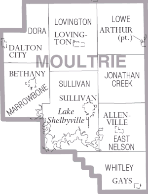
| Description | Moultrie County Illinois | |||
| Date | ||||
| Source | https://www.census.gov\/prod/cen2000/phc-1-15.pdf | |||
| Author | US Census Bureau, Cropped by uploader | |||
| Permission (Reusing this file) |
|

File history
Click on a date/time to view the file as it appeared at that time.
| Date/Time | Thumbnail | Dimensions | User | Comment | |
|---|---|---|---|---|---|
| current | 18:02, 3 February 2007 | | 300 × 392 (12 KB) | Dual Freq (talk | contribs) | {{Information |Description=Moultrie County Illinois |Source=http://www.census.gov/prod/cen2000/phc-1-15.pdf |Date=2000 |Author=US Census Bureau, Cropped by uploader |Permission={{PD-USGov-DOC-Census}} |other_versions= }} Category:Maps of Illinois |
You cannot overwrite this file.
File usage on Commons
There are no pages that use this file.
File usage on other wikis
The following other wikis use this file:
- Usage on de.wikipedia.org
- Usage on en.wikipedia.org
- Usage on es.wikipedia.org
- Usage on ja.wikipedia.org
- Usage on nl.wikipedia.org
- Usage on pl.wikipedia.org