File:Map of New York highlighting Richmond County.svg
Jump to navigation
Jump to search

Size of this PNG preview of this SVG file: 787 × 600 pixels. Other resolutions: 315 × 240 pixels | 630 × 480 pixels | 1,008 × 768 pixels | 1,280 × 976 pixels | 2,560 × 1,951 pixels | 6,599 × 5,030 pixels.
Original file (SVG file, nominally 6,599 × 5,030 pixels, file size: 112 KB)
Captions
Captions
Add a one-line explanation of what this file represents
Summary[edit]
| Description |
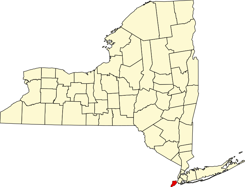
English: This is a locator map showing Richmond County in New York. For more information, see Commons:United States county locator maps. |
| Date | |
| Source |
Own work: English: The maps use data from nationalatlas.gov, specifically countyp020.tar.gz on the Raw Data Download page. The maps also use state outline data from statesp020.tar.gz. The Florida maps use hydrogm020.tar.gz to display Lake Okeechobee. |
| Author | David Benbennick |
Licensing[edit]
| I, the copyright holder of this work, release this work into the public domain. This applies worldwide. In some countries this may not be legally possible; if so: I grant anyone the right to use this work for any purpose, without any conditions, unless such conditions are required by law. |
File history
Click on a date/time to view the file as it appeared at that time.
| Date/Time | Thumbnail | Dimensions | User | Comment | |
|---|---|---|---|---|---|
| current | 15:33, 12 February 2006 | | 6,599 × 5,030 (112 KB) | David Benbennick (talk | contribs) | {{subst:User:Dbenbenn/clm|county=Richmond County|state=New York|type=county}} |
You cannot overwrite this file.
File usage on Commons
The following 2 pages use this file:
File usage on other wikis
The following other wikis use this file:
- Usage on azb.wikipedia.org
- Usage on bpy.wikipedia.org
- Usage on cy.wikipedia.org
- Usage on de.wikipedia.org
- Usage on en.wikipedia.org
- List of counties in New York
- Staten Island
- Richmondtown, Staten Island
- Isle of Meadows
- Prall's Island
- Stapleton Heights, Staten Island
- Castleton, Staten Island
- Arrochar, Staten Island
- Richmond Creek (Fresh Kills)
- Wikipedia:WikiProject New York City
- Annadale, Staten Island
- Richmond Valley, Staten Island
- Bay Terrace, Staten Island
- Sunnyside, Staten Island
- Concord, Staten Island
- Meiers Corners, Staten Island
- Ward Hill, Staten Island
- Emerson Hill, Staten Island
- Egbertville, Staten Island
- Greenridge, Staten Island
- Randall Manor, Staten Island
- Shore Acres, Staten Island
- Brighton Heights, Staten Island
- Port Ivory, Staten Island
- National Register of Historic Places listings in Staten Island
- Aspen Knolls
- Manor Heights, Staten Island
- Tappen Park
- Long Pond Park
- Bloomingdale Park
- Wolfe's Pond Park
- New Creek (Staten Island)
- Template:StatenIsland-geo-stub
- Willowbrook Park
- Arlington, Staten Island
- Chelsea, Staten Island
- Old Place, Staten Island
- Southfield, Staten Island
- Middletown, Staten Island
- Westfield, Staten Island
- Northfield, Staten Island
- Fresh Kills
- Tompkins Circle
- Ingram Woods
View more global usage of this file.