File:Map of Toyama Prefecture Ja.svg

Original file (SVG file, nominally 540 × 482 pixels, file size: 11 KB)
Captions
Captions
Summary[edit]
| Description |
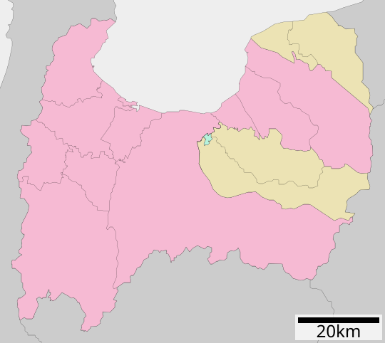
English: Map of Toyama Prefecture, Japan.
日本語: ja:富山県区画図 |
||
| Date | (UTC) | ||
| Source |
|
||
| Author | Lincun | ||
| Permission (Reusing this file) |
|
Licensing[edit]

|
Permission is granted to copy, distribute and/or modify this document under the terms of the GNU Free Documentation License, Version 1.2 or any later version published by the Free Software Foundation; with no Invariant Sections, no Front-Cover Texts, and no Back-Cover Texts. A copy of the license is included in the section entitled GNU Free Documentation License. |
- You are free:
- to share – to copy, distribute and transmit the work
- to remix – to adapt the work
- Under the following conditions:
- attribution – You must give appropriate credit, provide a link to the license, and indicate if changes were made. You may do so in any reasonable manner, but not in any way that suggests the licensor endorses you or your use.
- share alike – If you remix, transform, or build upon the material, you must distribute your contributions under the same or compatible license as the original.
Original upload log[edit]
| This file was moved from Japanese Wikipedia.
See below for original file information. | ||||||||||||||||||||||||||||||||||||
| ||||||||||||||||||||||||||||||||||||
|
| ||||||||||||||||||||||||||||||||||||
File history
Click on a date/time to view the file as it appeared at that time.
| Date/Time | Thumbnail | Dimensions | User | Comment | |
|---|---|---|---|---|---|
| current | 04:25, 4 December 2020 | | 540 × 482 (11 KB) | AichiWikiFixer (talk | contribs) | Update borders and fixes. |
| 01:41, 5 July 2013 |  | 560 × 600 (15 KB) | ニンジンシチュー (talk | contribs) | デザイン変更 | |
| 01:40, 5 July 2013 |  | 560 × 600 (15 KB) | ニンジンシチュー (talk | contribs) | デザイン変更 | |
| 22:25, 7 May 2008 |  | 560 × 692 (9 KB) | Krisgrotius (talk | contribs) | {{Information| |Description= Map of Toyama Prefecture, Japan. |Source= Japanese wiki [http://ja.wikipedia.org/wiki/%E7%94%BB%E5%83%8F:%E5%8C%85%E6%8B%AC%E8%87%AA%E6%B2%BB%E4%BD%93%E5%8C%BA%E7%94%BB%E5%9B%B3_16000.svg] |Date=~~~~~ |Author=[[:ja: 利用� | |
| 13:22, 3 October 2007 |  | 560 × 692 (9 KB) | Lincun (talk | contribs) | {{基礎自治体位置図画像情報|富山県|}} |
You cannot overwrite this file.
File usage on Commons
The following 3 pages use this file:
- Maps of Toyama prefecture
- Toyama prefecture
- File:包括自治体区画図 16000.svg (file redirect)
File usage on other wikis
The following other wikis use this file:
- Usage on bg.wikipedia.org
- Usage on de.wikipedia.org
- Usage on en.wikipedia.org
- Usage on gl.wikipedia.org
- Usage on id.wikipedia.org
- Usage on ja.wikipedia.org
- 小矢部川サービスエリア
- 呉羽パーキングエリア
- 流杉パーキングエリア
- 有磯海サービスエリア
- 越中境パーキングエリア
- 入善パーキングエリア
- 城端サービスエリア
- 富山空港
- 富山県立近代美術館
- 小矢部インターチェンジ
- 砺波インターチェンジ
- 高岡パーキングエリア
- 小杉インターチェンジ
- 富山西インターチェンジ
- 立山インターチェンジ
- 滑川インターチェンジ
- 魚津インターチェンジ
- 黒部インターチェンジ
- 富山インターチェンジ
- 五箇山インターチェンジ
- 福光インターチェンジ
- 小矢部東インターチェンジ
- 福岡インターチェンジ (富山県)
- 福岡パーキングエリア
- 高岡インターチェンジ
- 小矢部砺波ジャンクション
- 朝日インターチェンジ
- 富山県総合運動公園陸上競技場
- 富山市民球場アルペンスタジアム
- 富山城
- 太閤山
- となみ衛星通信テレビ
- 高岡北インターチェンジ
- 魚津桃山運動公園
- 富山競輪場
- 鯰温泉
- みくりが池温泉
- 立山温泉
- 片山学園中学校・高等学校
- 富山県立富山商業高等学校
- 富山県立福岡高等学校
- 富山県立新湊高等学校
- 富山県立大学
- 富山県立富山中部高等学校
- 富山市ファミリーパーク
View more global usage of this file.