File:Map of USA with county outlines (black & white).png
Jump to navigation
Jump to search

Size of this preview: 800 × 520 pixels. Other resolutions: 320 × 208 pixels | 640 × 416 pixels | 1,024 × 665 pixels | 1,513 × 983 pixels.
Original file (1,513 × 983 pixels, file size: 56 KB, MIME type: image/png)
Captions
Captions
Add a one-line explanation of what this file represents

|
File:Usa counties large.svg is a vector version of this file. It should be used in place of this PNG file when not inferior.
File:Map of USA with county outlines (black & white).png → File:Usa counties large.svg
For more information, see Help:SVG. |
 |
Summary[edit]
.png&action=edit§ion=1)
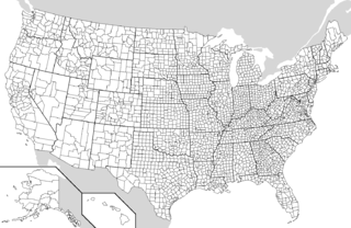
| Description | Map of the USA showing borders of states and counties. Adapted by Wapcaplet from a public-domain map courtesy of the U.S. Census Bureau website. |
| Date | |
| Source | en:File:Map of USA with county outlines.png |
| Author | |
| Other versions |
Derivative works of this file: File:Map of USA with county outlines.png |
Licensing[edit]
.png&action=edit§ion=2)
| This file is licensed under the Creative Commons Attribution-Share Alike 3.0 Unported license. Subject to disclaimers. | ||
| ||
| This licensing tag was added to this file as part of the GFDL licensing update. |

|
Permission is granted to copy, distribute and/or modify this document under the terms of the GNU Free Documentation License, Version 1.2 or any later version published by the Free Software Foundation; with no Invariant Sections, no Front-Cover Texts, and no Back-Cover Texts. A copy of the license is included in the section entitled GNU Free Documentation License. Subject to disclaimers. |
File history
Click on a date/time to view the file as it appeared at that time.
| Date/Time | Thumbnail | Dimensions | User | Comment | |
|---|---|---|---|---|---|
| current | 09:34, 25 September 2006 | | 1,513 × 983 (56 KB) | Poulpy (talk | contribs) | {{Information |Description=Map of the USA showing borders of states and counties. Adapted by Wapcaplet from a public-domain map courtesy of the [http://www.census.gov/ U.S. Census Bureau website]. |Source=[[:en:Image:Map of USA w |
You cannot overwrite this file.
File usage on Commons
The following 6 pages use this file:
File usage on other wikis
The following other wikis use this file:
- Usage on en.wikipedia.org
- Usage on mwl.wikipedia.org
- Usage on pt.wikipedia.org
- Usage on ro.wikipedia.org
.png&oldid=681388750)