File:Map of the Arab-Israeli conflict-blank.svg
Jump to navigation
Jump to search

Size of this PNG preview of this SVG file: 800 × 426 pixels. Other resolutions: 320 × 170 pixels | 640 × 341 pixels | 1,024 × 545 pixels | 1,280 × 682 pixels | 2,560 × 1,363 pixels | 920 × 490 pixels.
Original file (SVG file, nominally 920 × 490 pixels, file size: 450 KB)
Captions
Captions
Add a one-line explanation of what this file represents
Summary[edit]
| Description |
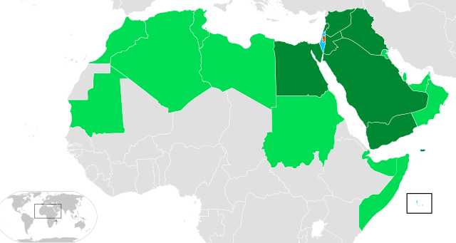
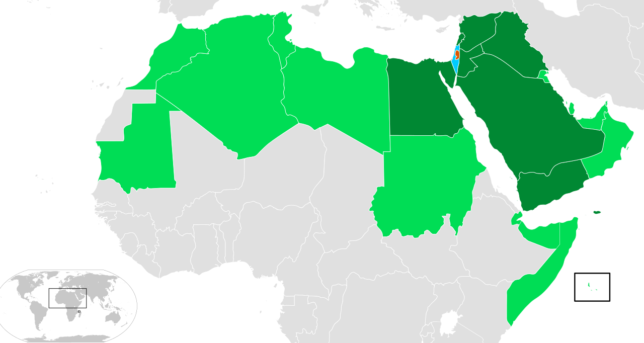
Français : Carte d'Israël et des membres de la Ligue arabe (les Comores sont visibles en bas à droite)
|
| Date | (UTC) |
| Source | Own work |
| Author | ҉ Cerveaugenie |
Israel
Gaza and the West Bank (State of Palestine)
Arab League countries
Arab League countries that have been in war with Israel
Licensing[edit]
I, the copyright holder of this work, hereby publish it under the following licenses:

|
Permission is granted to copy, distribute and/or modify this document under the terms of the GNU Free Documentation License, Version 1.2 or any later version published by the Free Software Foundation; with no Invariant Sections, no Front-Cover Texts, and no Back-Cover Texts. A copy of the license is included in the section entitled GNU Free Documentation License. |
This file is licensed under the Creative Commons Attribution-Share Alike 3.0 Unported, 2.5 Generic, 2.0 Generic and 1.0 Generic license.
- You are free:
- to share – to copy, distribute and transmit the work
- to remix – to adapt the work
- Under the following conditions:
- attribution – You must give appropriate credit, provide a link to the license, and indicate if changes were made. You may do so in any reasonable manner, but not in any way that suggests the licensor endorses you or your use.
- share alike – If you remix, transform, or build upon the material, you must distribute your contributions under the same or compatible license as the original.
You may select the license of your choice.
File history
Click on a date/time to view the file as it appeared at that time.
| Date/Time | Thumbnail | Dimensions | User | Comment | |
|---|---|---|---|---|---|
| current | 11:00, 21 August 2013 | | 920 × 490 (450 KB) | Hytar (talk | contribs) | Redone from scratch, exclude South Sudan and Western Sahara from Arab League |
| 12:18, 8 July 2008 |  | 940 × 477 (1.87 MB) | Cerveaugenie (talk | contribs) | +mauritanie | |
| 10:22, 8 July 2008 |  | 940 × 477 (1.87 MB) | Cerveaugenie (talk | contribs) | colours | |
| 17:28, 7 July 2008 |  | 940 × 477 (1.87 MB) | Cerveaugenie (talk | contribs) | {{Information |Description={{en|1=Map of Israel and members of the Arab League (Comoros is shown in bottom right).}} {{fr|1=Carte d'Israël et des membres de la fr:Ligue Arabe (les Comores son visibles en bas � |
You cannot overwrite this file.
File usage on Commons
The following page uses this file:
File usage on other wikis
The following other wikis use this file:
- Usage on als.wikipedia.org
- Usage on de.wikipedia.org
- Usage on en.wikipedia.org
- Usage on es.wikipedia.org
- Usage on gl.wikipedia.org
- Usage on gn.wikipedia.org
- Usage on ka.wikipedia.org
- Usage on www.wikidata.org
- Usage on zh.wikipedia.org