File:Mapa Mezopotámie.png
Jump to navigation
Jump to search

Size of this preview: 800 × 485 pixels. Other resolutions: 320 × 194 pixels | 640 × 388 pixels | 1,024 × 621 pixels | 1,280 × 776 pixels | 2,440 × 1,480 pixels.
Original file (2,440 × 1,480 pixels, file size: 1.42 MB, MIME type: image/png)
Captions
Captions
Add a one-line explanation of what this file represents

|
Permission is granted to copy, distribute and/or modify this document under the terms of the GNU Free Documentation License, Version 1.2 or any later version published by the Free Software Foundation; with no Invariant Sections, no Front-Cover Texts, and no Back-Cover Texts. A copy of the license is included in the section entitled GNU Free Documentation License. |
| This file is licensed under the Creative Commons Attribution-Share Alike 3.0 Unported license. | ||
| Attribution: Maros | ||
| ||
| This licensing tag was added to this file as part of the GFDL licensing update. |
Summary[edit]
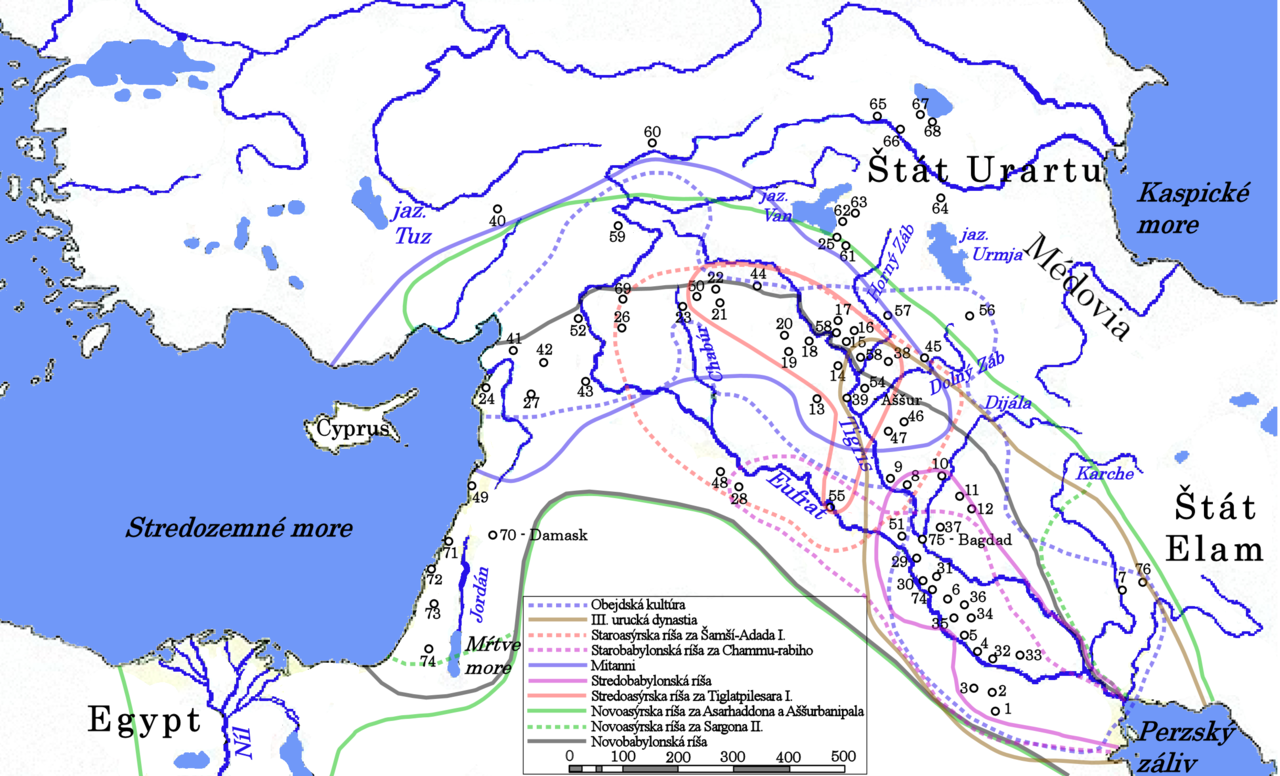
Sídla vyznačené na mape (podľa abecedy):
|
|
|
File history
Click on a date/time to view the file as it appeared at that time.
| Date/Time | Thumbnail | Dimensions | User | Comment | |
|---|---|---|---|---|---|
| current | 21:53, 8 December 2007 | | 2,440 × 1,480 (1.42 MB) | Wizzard (talk | contribs) | {{GFDL-user-w|sk|wikipedia|Maros}} == Opis súboru == Sídla vyznačené na mape (podľa abecedy): {| style="border:1px none #000000; padding: 10px" | valign="top" | :41 Alalach :60 Altintepe :65 Argištichinili :46 Arrapcha :39 [[Aššu |
You cannot overwrite this file.
File usage on Commons
There are no pages that use this file.
File usage on other wikis
The following other wikis use this file:
- Usage on az.wikipedia.org
- Usage on ca.wikipedia.org
- Usage on fr.wikipedia.org